|
search place name
|
||
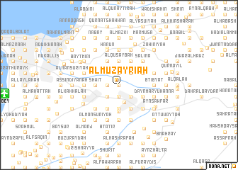
Al Muzayri‘ah (Mont-Liban, Lebanon)Al Muzayri‘ah is a town in the Mont-Liban region of Lebanon. An overview map of the region around Al Muzayri‘ah is displayed below.
regional and 3d topo map of Al Muzayri‘ah, Lebanon ::
Al Muzayri‘ah airports ::
The nearest airport is BEY - Beirut Rafic Hariri Intl, located 15.0 km west of Al Muzayri‘ah.
Other airports nearby include DAM - Damascus Intl (92.9 km south east), RPN - Rosh Pina Mahanaim I Ben Yaakov (94.8 km south), HFA - Haifa (126.8 km south west), OMF - Mafraq King Hussein (173.4 km south), Nearby towns ::
Ruʼaysat al Ballūţ (0.0km north) //
An Nab‘ah (0.0km north) //
Dayr Khūnā (0.0km north) //
Ba‘lshmayh al Jadīdah (1.9km south) //
Al Ḩārah (1.9km south) //
‘Ayn Muwaffaq (1.9km south) //
Al Hilālīyah (1.5km west) //
Raʼs al Matn (1.9km north) //
Ba‘lshmayh (2.4km south west) //
Ḩārat Ḩamzah (2.4km south east) //
Raʼs al Ḩarf (2.4km south east) //
Qtālah (2.4km south east) //
Ḑuhūr al ‘Ibādīyah (2.4km south west) //
Al Kaḩlūnīyah (2.4km south east) //
Bta‘līn (2.4km north east) //
Bḩamdūn al Maḩaţţah (2.8km south) //
Shwīt (3.1km west) //
Al ‘Abbādīyah (3.1km west) //
Al Manţarah (3.7km south) //
Al Quşaybah (3.7km north) //
Qibbay‘ (3.6km south east) //
Ruʼaysat Qibbay‘ (3.6km south east) //
Dayr Mār Yūḩannā (3.6km south east) //
Al Qurayyah (4.0km south east) //
‘Ayn al Muhnaydah (3.6km north east) //
Dayr al Ḩarf (3.6km north east) //
‘Ayn al Jadīdah (4.0km south west) //
Zandūqah (4.0km north west) //
Qirţāḑah (4.0km north west) //
[all distances 'as the bird flies' and approximate] 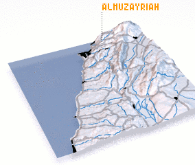 Places with similar names to Al Muzayri‘ah, Lebanon ::
// Al Muzayrah (IQ)
// Almaşar (TR)
// Al Mazārah (TN)
// Almazorre (ES)
// Almuzara (ES)
// Alamsar (IN)
// Alimsere (KZ)
// Al Masarrah (SA)
// Al Masarrah (JO)
// Al Mazār (JO)
Disclaimer :: Information on this page comes without warranty of any kind |
||
|
Where is Al Muzayri‘ah? Elevation and coordinates ::
Latitude (lat): 33°50'0"N Longitude (lon): 35°39'0"E
Elevation (approx.): 489m (map arrows pan, magnifying glasses zoom) |
||
|
Visiting Al Muzayri‘ah? Hotel/Accommodation ::
Book a hotel in Al Muzayri‘ah Travel Guide ::
Buy a travel guide for Lebanon rental cars ::
car rental offers GPS waypoint ::
download a GPX waypoint (PoI) of Al Muzayri‘ah for your GPS receiver
|
||