|
search place name
|
||
Al Wardānī (Lebanon)Al Wardānī is a town in Lebanon. An overview map of the region around Al Wardānī is displayed below.
regional and 3d topo map of Al Wardānī, Lebanon ::

Al Wardānī airports ::
The nearest airport is RPN - Rosh Pina Mahanaim I Ben Yaakov, located 35.1 km south east of Al Wardānī.
Other airports nearby include HFA - Haifa (49.5 km south west), BEY - Beirut Rafic Hariri Intl (71.1 km north), DAM - Damascus Intl (115.5 km east), OMF - Mafraq King Hussein (129.7 km south east), Nearby towns ::
Qānā (0.9km north) //
Aş Şiddīqīn (1.4km south east) //
Al Khuraybah (1.9km north) //
Ramādīyah (1.6km west) //
Al Bayyāḑ (1.6km east) //
Jibāl al Buţm (2.4km south west) //
Rishknānīyah (2.4km south east) //
Mazra‘at ‘Ayyah (2.4km south east) //
Ash Sh‘aytīyah (3.1km west) //
‘Aytīt (3.7km north) //
Dayr ‘Āmiş (3.1km east) //
Raqlīyah (4.0km north west) //
Ḩannāwīyah (3.6km north west) //
Al Knaysah (3.6km north west) //
Mazra‘at al Mushrif (3.6km north east) //
‘Ayn B‘āl (4.5km north west) //
Zibqīn (4.9km south west) //
Wādī Jīlū (5.6km north) //
Bmaryamīn (5.6km south) //
Jwayyā (5.4km north east) //
Al Mālikīyah (5.0km west) //
Dayr Qānūn (5.0km west) //
Mashtá al ‘Izzīyah (5.0km west) //
Maḩrūnah (5.0km east) //
Yāţar (5.7km south east) //
Kafrā (5.4km south east) //
Bātūlayh (5.9km north west) //
Al Bāzūrīyah (6.4km north west) //
Yānūḩ (7.4km north) //
[all distances 'as the bird flies' and approximate] 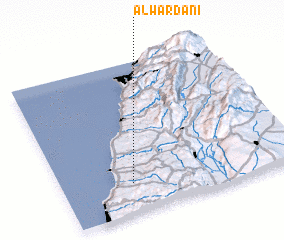 Places with similar names to Al Wardānī, Lebanon ::
// Allwörden (DE)
Disclaimer :: Information on this page comes without warranty of any kind |
||
|
Where is Al Wardānī? Elevation and coordinates ::
Latitude (lat): 33°12'0"N Longitude (lon): 35°18'0"E
Elevation (approx.): 334m (map arrows pan, magnifying glasses zoom) |
||
|
Visiting Al Wardānī? Hotel/Accommodation ::
Book a hotel in Al Wardānī Travel Guide ::
Buy a travel guide for Lebanon rental cars ::
car rental offers GPS waypoint ::
download a GPX waypoint (PoI) of Al Wardānī for your GPS receiver
|
||