|
search place name
|
||
As Sulţān Ya‘qūb at Taḩtā (Béqaa, Lebanon)As Sulţān Ya‘qūb at Taḩtā is a town in the Béqaa region of Lebanon. An overview map of the region around As Sulţān Ya‘qūb at Taḩtā is displayed below.
regional and 3d topo map of As Sulţān Ya‘qūb at Taḩtā, Lebanon ::

As Sulţān Ya‘qūb at Taḩtā airports ::
The nearest airport is BEY - Beirut Rafic Hariri Intl, located 38.5 km north west of As Sulţān Ya‘qūb at Taḩtā.
Other airports nearby include DAM - Damascus Intl (67.2 km south east), RPN - Rosh Pina Mahanaim I Ben Yaakov (78.6 km south), HFA - Haifa (119.8 km south west), OMF - Mafraq King Hussein (148.5 km south), Nearby towns ::
As Sulţān Ya‘qūb (1.3km south east) //
Lūsī (1.5km west) //
Tall az Za‘āzi‘ (1.9km north) //
Ghazzah (3.0km north west) //
Al Khiyārah (3.7km north) //
Ḩammārah (3.4km east) //
Kāmid al Lawz (4.3km south west) //
Al Manşūrah (4.6km north west) //
Ad Dakwah (5.1km north east) //
Mdūkhā (5.5km south east) //
‘Aytā al Fukhkhār (5.0km east) //
Mazra‘at ‘Azzah (5.8km south) //
Mazra‘at ‘Ayn Qanīyah (5.9km south east) //
Al Jazīrah (7.4km north) //
Taaïlet (7.6km south) //
Tall Dhnūb (6.4km west) //
Ḩawsh al Ḩarīmah (7.7km north) //
Joub Jannine (6.7km south west) //
El Bîré (7.9km south) //
Aş Şawīrah (7.2km north east) //
Ez Zâroûb (8.0km south west) //
Aïn Aarab (8.4km south) //
Khirbet Roûha (8.5km south) //
Majdal ‘Anjar (8.0km north east) //
Raïssé (8.7km south) //
El Derrânïyât (8.9km south) //
Er Rafîd (9.1km south) //
Bakkā (9.3km south east) //
Kaffet el Ghrâb (9.8km south west) //
[all distances 'as the bird flies' and approximate] 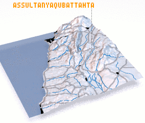 Places with similar names to As Sulţān Ya‘qūb at Taḩtā, Lebanon :: Disclaimer :: Information on this page comes without warranty of any kind |
||
|
Where is As Sulţān Ya‘qūb at Taḩtā? Elevation and coordinates ::
Latitude (lat): 33°39'0"N Longitude (lon): 35°51'0"E
Elevation (approx.): 1025m (map arrows pan, magnifying glasses zoom) |
||
|
Visiting As Sulţān Ya‘qūb at Taḩtā? Hotel/Accommodation ::
Book a hotel in As Sulţān Ya‘qūb at Taḩtā Travel Guide ::
Buy a travel guide for Lebanon rental cars ::
car rental offers GPS waypoint ::
download a GPX waypoint (PoI) of As Sulţān Ya‘qūb at Taḩtā for your GPS receiver
|
||