|
search place name
|
||
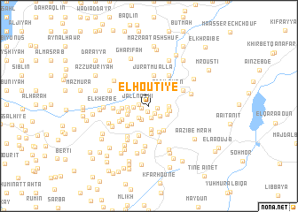
El Hoûtîyé (Lebanon)El Hoûtîyé is a town in Lebanon. An overview map of the region around El Hoûtîyé is displayed below.
regional and 3d topo map of El Hoûtîyé, Lebanon ::
El Hoûtîyé airports ::
The nearest airport is BEY - Beirut Rafic Hariri Intl, located 27.8 km north of El Hoûtîyé.
Other airports nearby include RPN - Rosh Pina Mahanaim I Ben Yaakov (66.6 km south), DAM - Damascus Intl (89.1 km east), HFA - Haifa (99.1 km south west), OMF - Mafraq King Hussein (150.1 km south east), Nearby towns ::
Benouâté (0.8km south) //
Machmoûché (0.8km west) //
El Ghabbatîyé (1.0km east) //
Kfar Taala (1.1km south east) //
Jall Nāshī (1.0km west) //
Al Ḩūrānīyah (1.0km west) //
Bkâssîne (1.6km south) //
Chouqfâne el Aarâyes (1.7km south east) //
Sabbah (1.9km south west) //
Bteddîne el Liqch (1.9km south west) //
El Msoûs (1.7km west) //
Bhannîne (2.1km east) //
Deïr el Moukhallès (2.1km east) //
Er Ridm (2.2km south east) //
El Harf (2.3km west) //
Es Soueïda (2.3km east) //
Ed Darjé (2.3km west) //
Ej Jdaïdé (2.9km south) //
El Manzalé (2.6km south west) //
El Mlâzeq (2.9km south west) //
Mazra‘at Khafīshah (2.9km north east) //
Ad Dilghān (2.9km north east) //
El Lzâq (2.8km west) //
Ech Chamkha (3.4km south) //
Ouâdi Jezzîne (3.6km south) //
Aazibiett Tahta (3.5km south east) //
Bsābā (3.3km north west) //
El Hartaqa (3.4km south west) //
El Bazzâra (3.3km south west) //
[all distances 'as the bird flies' and approximate] 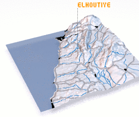 Places with similar names to El Hoûtîyé, Lebanon ::
// El Hadâya (LB)
Disclaimer :: Information on this page comes without warranty of any kind |
||
|
Where is El Hoûtîyé? Elevation and coordinates ::
Latitude (lat): 33°34'55"N Longitude (lon): 35°34'40"E
Elevation (approx.): 763m (map arrows pan, magnifying glasses zoom) |
||
|
Visiting El Hoûtîyé? Hotel/Accommodation ::
Book a hotel in El Hoûtîyé Travel Guide ::
Buy a travel guide for Lebanon rental cars ::
car rental offers GPS waypoint ::
download a GPX waypoint (PoI) of El Hoûtîyé for your GPS receiver
|
||