|
search place name
|
||
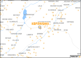
Kafr Mishkī (Béqaa, Lebanon)Kafr Mishkī is a town in the Béqaa region of Lebanon. An overview map of the region around Kafr Mishkī is displayed below.
regional and 3d topo map of Kafr Mishkī, Lebanon ::
Kafr Mishkī airports ::
The nearest airport is BEY - Beirut Rafic Hariri Intl, located 42.7 km north west of Kafr Mishkī.
Other airports nearby include RPN - Rosh Pina Mahanaim I Ben Yaakov (61.9 km south), DAM - Damascus Intl (70.4 km east), HFA - Haifa (103.3 km south west), OMF - Mafraq King Hussein (136.4 km south), Nearby towns ::
Kfarmechkî (0.5km north east) //
El Gharqa (1.8km north east) //
Kaoukaba Bou Aarab (2.5km north east) //
Kawkabā Bū ‘Arab (2.6km north east) //
Qna‘bah (3.4km south) //
El Malloûl (3.0km north east) //
Marj es Samâh (3.0km east) //
Majdal Balhîss (3.4km north west) //
‘Izz al ‘Arab (3.1km east) //
An Nab‘āt (3.8km south west) //
Marj as Samāḩ (3.5km south east) //
Al Qan‘abah (4.0km south) //
Aaz el Aarab (3.5km east) //
Al Ḩawsh (4.4km south) //
Ez Zaoura (3.7km east) //
Mazraat ech Chamîssé (3.7km west) //
Ed Darjé (4.2km north east) //
Tannūrah (4.6km south east) //
Mazra‘at Ja‘far (5.3km south) //
Bayt Lahyā (4.9km south east) //
El Outaïyât (5.5km north) //
Akbé (4.7km east) //
El Aaqabé (4.7km east) //
Libbāyā (5.5km south west) //
Aïn el Laboué (5.2km east) //
Bakkīfā (5.4km south east) //
Adh Dhunaybah (6.1km south west) //
Bâb el Ahmar (5.7km east) //
‘Ayn Ḩirshah (6.7km south) //
[all distances 'as the bird flies' and approximate] 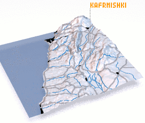 Places with similar names to Kafr Mishkī, Lebanon ::
// Kfarmechkî (LB)
Disclaimer :: Information on this page comes without warranty of any kind |
||
|
Where is Kafr Mishkī? Elevation and coordinates ::
Latitude (lat): 33°30'51"N Longitude (lon): 35°46'0"E
Elevation (approx.): 1174m (map arrows pan, magnifying glasses zoom) |
||
|
Visiting Kafr Mishkī? Hotel/Accommodation ::
Book a hotel in Kafr Mishkī Travel Guide ::
Buy a travel guide for Lebanon rental cars ::
car rental offers GPS waypoint ::
download a GPX waypoint (PoI) of Kafr Mishkī for your GPS receiver
|
||