|
search place name
|
||
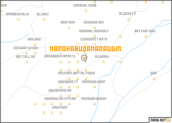
Marāḩ Abū Qamar ad Dīn (Béqaa, Lebanon)Marāḩ Abū Qamar ad Dīn is a town in the Béqaa region of Lebanon. An overview map of the region around Marāḩ Abū Qamar ad Dīn is displayed below.
regional and 3d topo map of Marāḩ Abū Qamar ad Dīn, Lebanon ::
Marāḩ Abū Qamar ad Dīn airports ::
The nearest airport is BEY - Beirut Rafic Hariri Intl, located 101.1 km south west of Marāḩ Abū Qamar ad Dīn.
Other airports nearby include DAM - Damascus Intl (109.0 km south), LTK - Latakia Bassel Al Assad Intl (118.7 km north), RPN - Rosh Pina Mahanaim I Ben Yaakov (171.5 km south west), PMS - Palmyra (181.7 km east), Nearby towns ::
Marāḩ Bayt ‘Allū (1.9km south) //
Marāḩ as Sīyād (1.9km south) //
Marāḩ ‘Abbās (1.9km north) //
Marāḩ ash Shunayn (1.9km north) //
Marāḩ at Tirkhin (1.5km west) //
Marāḩ al Ballūţ (2.4km south west) //
Marāḩ Bayt al ‘Abd (2.4km north west) //
Hermel (3.1km east) //
Al Hirmil (3.1km east) //
Marāḩ al ‘Utaybah (3.7km south) //
Marāḩ al Mughr (3.1km west) //
Marāḩ Nāʼif (3.1km west) //
Zighrīn (3.7km north) //
Jāmi‘ Wādī Zighrīn (3.7km north) //
Wādī at Turkumān (3.6km south west) //
Qirrayţah (3.6km south west) //
Mazra‘at Bayt al Faqīh (4.0km south) //
Al Buqūl (4.0km north) //
Zighrīn at Taḩtā (4.0km north) //
Marāḩ Zuwaytīnah (4.8km south west) //
Raʼs ‘Aqabat ar Raţl (4.6km west) //
Marāḩ Wādī al Mallūl (4.6km west) //
Marāḩ Qirrayţah (4.9km west) //
Marāḩ Yāsīn (5.8km south) //
Marāḩ aḑ Ḑahr (5.8km south) //
Marāḩ Ḩiqāb an Najjār (5.8km south) //
Al Barghash (4.9km west) //
Marāḩ al Mashraf (5.8km north) //
Wādī Bunayt (6.3km south west) //
[all distances 'as the bird flies' and approximate] 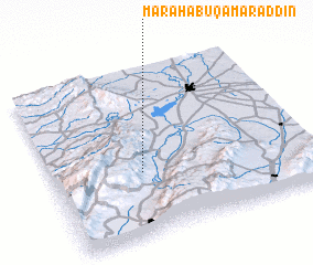 Places with similar names to Marāḩ Abū Qamar ad Dīn, Lebanon :: Disclaimer :: Information on this page comes without warranty of any kind |
||
|
Where is Marāḩ Abū Qamar ad Dīn? Elevation and coordinates ::
Latitude (lat): 34°23'0"N Longitude (lon): 36°21'0"E
Elevation (approx.): 1192m (map arrows pan, magnifying glasses zoom) |
||
|
Visiting Marāḩ Abū Qamar ad Dīn? Hotel/Accommodation ::
Book a hotel in Marāḩ Abū Qamar ad Dīn Travel Guide ::
Buy a travel guide for Lebanon rental cars ::
car rental offers GPS waypoint ::
download a GPX waypoint (PoI) of Marāḩ Abū Qamar ad Dīn for your GPS receiver
|
||