|
search place name
|
||
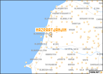
Mazra‘at Jamjīm (Lebanon)Mazra‘at Jamjīm is a town in Lebanon. An overview map of the region around Mazra‘at Jamjīm is displayed below.
regional and 3d topo map of Mazra‘at Jamjīm, Lebanon ::
Mazra‘at Jamjīm airports ::
The nearest airport is RPN - Rosh Pina Mahanaim I Ben Yaakov, located 50.5 km south east of Mazra‘at Jamjīm.
Other airports nearby include BEY - Beirut Rafic Hariri Intl (53.9 km north), HFA - Haifa (65.7 km south), DAM - Damascus Intl (114.6 km east), OMF - Mafraq King Hussein (144.6 km south east), Nearby towns ::
Balāţat al Jamjīm (0.0km north) //
Mazra‘at al Muḩaydilah (1.9km north) //
Al Ḩarithīyah (1.9km north) //
Jamjīm at Taḩtā (1.5km west) //
Mazra‘at as Sakanīyah (1.9km south) //
Mazra‘at Kafr Baddah (1.7km west) //
Mazra‘at Naḩḩūlah (2.4km north west) //
Mazra‘at al Wisāmīyāt (2.4km north east) //
Mazra‘at al Wāsiţah (2.4km south west) //
Al Kharāʼib (2.4km south east) //
Al Maḩmūdīyah (3.1km west) //
Mazra‘at Kawtharīyat ar Ruzz (3.1km east) //
Marāḩ al Jadīdah (3.7km south) //
Maţarīyat ash Shawmar (3.7km south) //
Mazra‘at al Manḩalah (4.0km north west) //
Mazra‘at Dayr Taqlā (4.0km north east) //
Mazra‘at ‘Ayn az Zarqāʼ (3.6km south west) //
Mazra‘at al ‘Aytānīyah (3.6km south west) //
Mazra‘at al Jūdīyah (3.6km south west) //
Mighrāqah (4.0km south west) //
Irzay (4.0km south east) //
‘Adlūn (4.2km north) //
Mazra‘at Buşaylah (4.8km south west) //
Khirbat ‘Ayn al Qanāţir (4.8km south west) //
Mazra‘at an Nabī Qāsim (4.8km south west) //
Al Qāsimīyah (4.8km south west) //
Al Inşārīyah (5.6km north) //
Bidyās (5.8km south) //
Az Zrārīyah (5.4km south east) //
[all distances 'as the bird flies' and approximate] 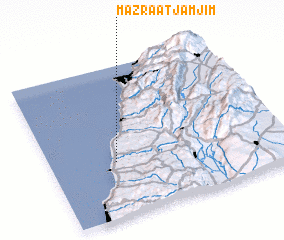 Places with similar names to Mazra‘at Jamjīm, Lebanon :: Disclaimer :: Information on this page comes without warranty of any kind |
||
|
Where is Mazra‘at Jamjīm? Elevation and coordinates ::
Latitude (lat): 33°22'0"N Longitude (lon): 35°17'0"E
Elevation (approx.): 62m (map arrows pan, magnifying glasses zoom) |
||
|
Visiting Mazra‘at Jamjīm? Hotel/Accommodation ::
Book a hotel in Mazra‘at Jamjīm Travel Guide ::
Buy a travel guide for Lebanon rental cars ::
car rental offers GPS waypoint ::
download a GPX waypoint (PoI) of Mazra‘at Jamjīm for your GPS receiver
|
||