|
search place name
|
||
Qal‘at Ţabbūsh (Mont-Liban, Lebanon)Qal‘at Ţabbūsh is a town in the Mont-Liban region of Lebanon. An overview map of the region around Qal‘at Ţabbūsh is displayed below.
regional and 3d topo map of Qal‘at Ţabbūsh, Lebanon ::

Qal‘at Ţabbūsh airports ::
The nearest airport is BEY - Beirut Rafic Hariri Intl, located 22.7 km north of Qal‘at Ţabbūsh.
Other airports nearby include RPN - Rosh Pina Mahanaim I Ben Yaakov (71.2 km south), HFA - Haifa (97.9 km south west), DAM - Damascus Intl (100.0 km east), OMF - Mafraq King Hussein (158.2 km south east), Nearby towns ::
Ḩārat at Taḩtā (0.0km north) //
Muţayrīyāt (0.0km north) //
Marj Kitrmāyā (0.0km north) //
Mazbūd (1.5km south east) //
Al Masrab (1.9km north) //
Dalhūn (1.9km north) //
Al Musayyid (1.5km east) //
Al Qal‘ah (1.5km east) //
Ḩaffat al Ḩajal (1.5km east) //
Qal‘at Sanyūrah (1.5km east) //
Shḩīm (1.7km north east) //
Marj ‘Alī (2.4km north east) //
Ash Shamīs (2.4km north west) //
Al Quray‘ah (2.4km south east) //
Al Mughayrīyah (2.4km south west) //
Siblīn (3.1km west) //
Sablīn (3.1km west) //
Al Wardānīyah (3.1km west) //
Kitrmāyā (3.1km west) //
Ḩārat al Mawārinah (3.7km south) //
Al ‘Aqabah (3.7km south) //
Joûn (4.1km south) //
‘Ayn al Ḩawr (4.0km north east) //
Al Burjayn (4.0km north east) //
Al Marj (4.0km north west) //
‘Ayn al Asad (4.0km north west) //
Mazmūrā (3.6km south east) //
Bakkīfā (3.6km south east) //
Al Ma‘nīyah (3.6km north west) //
[all distances 'as the bird flies' and approximate] 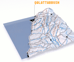 Places with similar names to Qal‘at Ţabbūsh, Lebanon ::
Disclaimer :: Information on this page comes without warranty of any kind |
||
|
Where is Qal‘at Ţabbūsh? Elevation and coordinates ::
Latitude (lat): 33°37'0"N Longitude (lon): 35°28'0"E
Elevation (approx.): 374m (map arrows pan, magnifying glasses zoom) |
||
|
Visiting Qal‘at Ţabbūsh? Hotel/Accommodation ::
Book a hotel in Qal‘at Ţabbūsh Travel Guide ::
Buy a travel guide for Lebanon rental cars ::
car rental offers GPS waypoint ::
download a GPX waypoint (PoI) of Qal‘at Ţabbūsh for your GPS receiver
|
||