|
search place name
|
||
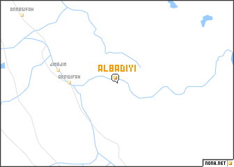
Al Badīyi‘ (Saudi Arabia)Al Badīyi‘ is a town in Saudi Arabia. An overview map of the region around Al Badīyi‘ is displayed below.
regional and 3d topo map of Al Badīyi‘, Saudi Arabia ::
Al Badīyi‘ airports ::
The nearest airport is URY - Guriat, located 66.2 km north west of Al Badīyi‘.
Other airports nearby include TUI - Turaif (121.0 km north east), AMM - Amman Queen Alia Intl (187.3 km north west), ADJ - Amman Marka Intl (200.9 km north west), OMF - Mafraq King Hussein (208.6 km north west), Nearby towns ::
Ar Ridīfah (6.5km west) //
[all distances 'as the bird flies' and approximate] 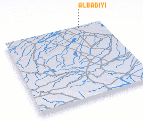 Places with similar names to Al Badīyi‘, Saudi Arabia ::
// Al Bayyāḑīyah (EG)
// Al Bādīyah (SA)
// Al Bidāyah (OM)
// Al Budāyah (OM)
// Al ‘Abdīyah (SY)
// Al Ab‘adīyah (EG)
// Al Ab‘ādīyah (EG)
// Al ‘Ubaydīyah (EG)
// Al ‘Abīdīyah (SA)
// Al ‘Abdīyah (SD)
Disclaimer :: Information on this page comes without warranty of any kind |
||
|
Where is Al Badīyi‘? Elevation and coordinates ::
Latitude (lat): 30°59'4"N Longitude (lon): 37°45'50"E
Elevation (approx.): 542m (map arrows pan, magnifying glasses zoom) |
||
|
Visiting Al Badīyi‘? Hotel/Accommodation ::
Book a hotel in Al Badīyi‘ Travel Guide ::
rental cars ::
car rental offers GPS waypoint ::
download a GPX waypoint (PoI) of Al Badīyi‘ for your GPS receiver
|
||