|
search place name
|
||
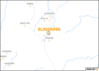
Al Mushīrah (Saudi Arabia)Al Mushīrah is a town in Saudi Arabia. An overview map of the region around Al Mushīrah is displayed below.
regional and 3d topo map of Al Mushīrah, Saudi Arabia ::
Al Mushīrah airports ::
The nearest airport is BHH - Bisha, located 83.7 km north east of Al Mushīrah.
Other airports nearby include ABT - El-baha Al Baha (89.6 km north west), AHB - Abha (162.2 km south east), TIF - Taif (260.4 km north west), Nearby towns ::
Al Ghat (1.7km west) //
Thammah (1.9km south) //
Ar Ruwayḩān (2.5km south west) //
Al Bahadah (5.6km north) //
Al ‘Ulyā (5.8km north) //
Al ‘Ulayyah (6.5km north) //
Al Harijan (7.4km north) //
[all distances 'as the bird flies' and approximate] 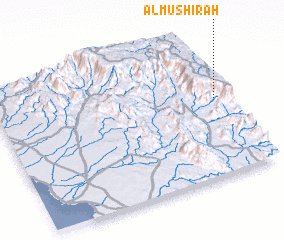 Places with similar names to Al Mushīrah, Saudi Arabia ::
// Al Musharraḩ (IQ)
// Almáchar (ES)
// Alamshīr (IR)
// Al Mashaēr (SA)
// Ālam Sher (PK)
// Alam Sherī (PK)
// Ālam Sheri (PK)
// Al Mushīr (SY)
// Al Mashrū‘ (IQ)
// Al Mashrū‘ (IQ)
Disclaimer :: Information on this page comes without warranty of any kind |
||
|
Where is Al Mushīrah? Elevation and coordinates ::
Latitude (lat): 19°33'0"N Longitude (lon): 41°58'0"E
Elevation (approx.): 2066m (map arrows pan, magnifying glasses zoom) |
||
|
Visiting Al Mushīrah? Hotel/Accommodation ::
Book a hotel in Al Mushīrah Travel Guide ::
rental cars ::
car rental offers GPS waypoint ::
download a GPX waypoint (PoI) of Al Mushīrah for your GPS receiver
|
||