|
search place name
|
||
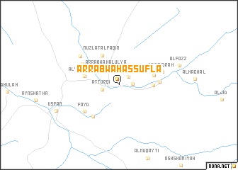
Ar Rabwah as Suflá (Makkah, Saudi Arabia)Ar Rabwah as Suflá is a town in the Makkah region of Saudi Arabia. An overview map of the region around Ar Rabwah as Suflá is displayed below.
regional and 3d topo map of Ar Rabwah as Suflá, Saudi Arabia ::
Ar Rabwah as Suflá airports ::
The nearest airport is JED - Jeddah King Abdulaziz Intl, located 42.1 km south west of Ar Rabwah as Suflá.
Other airports nearby include TIF - Taif (126.0 km south east), Nearby towns ::
Umm al Milḩ (1.9km north east) //
Umm al Jurm (2.0km east) //
Aţ Ţurqī (2.5km west) //
Ar Rabwah al ‘Ulyā (3.1km north west) //
Nuzlat al Faqīn (5.2km north west) //
Al Ḩarrāʼ (5.0km east) //
Al Yamānīyah (5.2km west) //
Ash Shi‘b (5.3km east) //
Az Zurra‘ (6.2km south west) //
Umm Surayḩah (6.0km east) //
Al Fayḑah (6.3km north west) //
Fayd (6.5km south west) //
Umm Sidrah (6.7km east) //
Al Muqr (7.3km north west) //
[all distances 'as the bird flies' and approximate]  Places with similar names to Ar Rabwah as Suflá, Saudi Arabia :: Disclaimer :: Information on this page comes without warranty of any kind |
||
|
Where is Ar Rabwah as Suflá? Elevation and coordinates ::
Latitude (lat): 21°57'19"N Longitude (lon): 39°26'12"E
Elevation (approx.): 153m (map arrows pan, magnifying glasses zoom) |
||
|
Visiting Ar Rabwah as Suflá? Hotel/Accommodation ::
Book a hotel in Ar Rabwah as Suflá Travel Guide ::
rental cars ::
car rental offers GPS waypoint ::
download a GPX waypoint (PoI) of Ar Rabwah as Suflá for your GPS receiver
|
||