|
search place name
|
||
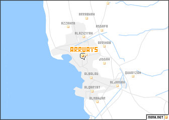
Ar Ruʼays (Makkah, Saudi Arabia)Ar Ruʼays is a town in the Makkah region of Saudi Arabia. An overview map of the region around Ar Ruʼays is displayed below.
regional and 3d topo map of Ar Ruʼays, Saudi Arabia ::
Ar Ruʼays airports ::
The nearest airport is JED - Jeddah King Abdulaziz Intl, located 17.4 km north of Ar Ruʼays.
Other airports nearby include TIF - Taif (141.5 km east), Nearby towns ::
Banī Mālik (1.2km north) //
Al Balad (4.2km south) //
Jiddah (4.2km east) //
Al ‘Azīzīyah (5.1km north) //
Ar Riḩāb (5.1km north east) //
Al Qaryāt (7.2km south) //
Aş Şafā (7.6km north east) //
Az Zahrāʼ (8.1km north west) //
Al Jāmi‘ah (9.0km south east) //
[all distances 'as the bird flies' and approximate] 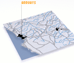 Places with similar names to Ar Ruʼays, Saudi Arabia ::
Disclaimer :: Information on this page comes without warranty of any kind |
||
|
Where is Ar Ruʼays? Elevation and coordinates ::
Latitude (lat): 21°31'25"N Longitude (lon): 39°10'46"E
Elevation (approx.): 14m (map arrows pan, magnifying glasses zoom) |
||
|
Visiting Ar Ruʼays? Hotel/Accommodation ::
Book a hotel in Ar Ruʼays Travel Guide ::
rental cars ::
car rental offers GPS waypoint ::
download a GPX waypoint (PoI) of Ar Ruʼays for your GPS receiver
|
||