|
search place name
|
||
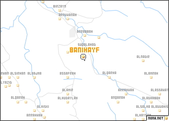
Banī Hayf (Saudi Arabia)Banī Hayf is a town in Saudi Arabia. An overview map of the region around Banī Hayf is displayed below.
regional and 3d topo map of Banī Hayf, Saudi Arabia ::
Banī Hayf airports ::
The nearest airport is AHB - Abha, located 21.2 km north west of Banī Hayf.
Other airports nearby include GIZ - Gizan King Abdullah Bin Abdulaziz (140.7 km south), EAM - Nejran (178.3 km east), BHH - Bisha (204.3 km north), Nearby towns ::
Sūq al Aḩad (2.6km north) //
Al Maraghah (4.0km north west) //
Aş Şafrah (5.1km south west) //
Ar Rabbah (5.6km north) //
Ad Darb (5.9km north east) //
Al Qarhāʼ (6.5km south east) //
Al ‘Āmir (8.2km south west) //
[all distances 'as the bird flies' and approximate] 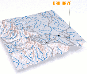 Places with similar names to Banī Hayf, Saudi Arabia ::
// Bonhof (DE)
// Bonnhof (DE)
// Ban Hua Fai (TH)
// Ban Hua Fai (TH)
// Ban Hua Fai (TH)
// Ban Hua Fai (TH)
// Ban Hua Fai (TH)
// Ban Hua Fai (TH)
// Ban Hua Fai (TH)
// Ban Hua Fai (TH)
Disclaimer :: Information on this page comes without warranty of any kind |
||
|
Where is Banī Hayf? Elevation and coordinates ::
Latitude (lat): 18°9'0"N Longitude (lon): 42°50'0"E
Elevation (approx.): 2111m (map arrows pan, magnifying glasses zoom) |
||
|
Visiting Banī Hayf? Hotel/Accommodation ::
Book a hotel in Banī Hayf Travel Guide ::
rental cars ::
car rental offers GPS waypoint ::
download a GPX waypoint (PoI) of Banī Hayf for your GPS receiver
|
||