|
search place name
|
||
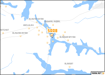
Şa‘ab (Ar Riyāḑ, Saudi Arabia)Şa‘ab is a town in the Ar Riyāḑ region of Saudi Arabia. An overview map of the region around Şa‘ab is displayed below.
regional and 3d topo map of Şa‘ab, Saudi Arabia ::
Şa‘ab airports ::
The nearest airport is RUH - Riyadh King Khaled Intl, located 63.0 km north east of Şa‘ab.
Nearby towns ::
Az Zuwaydīyah (1.4km south) //
Qaşr Fayhaq (1.5km north) //
Al Badī‘ah (1.7km east) //
Az Zumāmīyah (1.7km west) //
Al Fayḑah (2.5km south west) //
Al Wusţá (2.5km north west) //
Qaşr al Quraynah (3.6km east) //
Quşūr al Muqbil (3.9km north west) //
Al Bawāthil (3.8km north west) //
Quşūr al Muqbil (4.5km north) //
Şūr Bin Mizbil (4.5km north east) //
Qaşr Ibn Shuhayl (4.7km west) //
Al Fayşalīyah (5.1km north west) //
Al Maghrafīyah (5.1km east) //
Al Mulayḩīyah (5.5km north west) //
Ar Rafī‘ah (6.2km north west) //
Al Muţaywīyah (7.5km north west) //
Hazlūlah (8.4km north west) //
[all distances 'as the bird flies' and approximate] 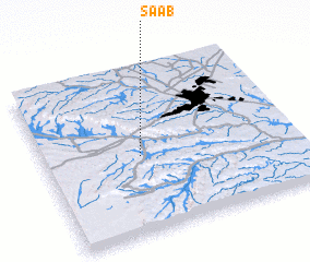 Places with similar names to Şa‘ab, Saudi Arabia ::
Disclaimer :: Information on this page comes without warranty of any kind |
||
|
Where is Şa‘ab? Elevation and coordinates ::
Latitude (lat): 24°28'1"N Longitude (lon): 46°23'1"E
Elevation (approx.): 617m (map arrows pan, magnifying glasses zoom) |
||
|
Visiting Şa‘ab? Hotel/Accommodation ::
Book a hotel in Şa‘ab Travel Guide ::
rental cars ::
car rental offers GPS waypoint ::
download a GPX waypoint (PoI) of Şa‘ab for your GPS receiver
|
||