|
search place name
|
||
Sa‘aibi (Saudi Arabia)Sa‘aibi is a town in Saudi Arabia. An overview map of the region around Sa‘aibi is displayed below.
regional and 3d topo map of Sa‘aibi, Saudi Arabia ::

Sa‘aibi airports ::
The nearest airport is ELQ - Gassim, located 111.9 km north west of Sa‘aibi.
Nearby towns ::
Rawshanīyah (1.9km south) //
Hadri (2.5km north east) //
Wuthaylān (3.1km north east) //
‘Ayn aş Şuwayni‘ (3.2km south east) //
Qaşr Badawī (4.1km north east) //
Sumlah (4.1km south east) //
Rawḑat Wuthaylān (4.7km north) //
Huwayyinah (6.5km south east) //
Qaşr Lahiya (7.6km north) //
Damthī (9.0km south east) //
Ash Shifallaḩīyah (9.3km north east) //
Mushrif (9.2km south east) //
[all distances 'as the bird flies' and approximate] 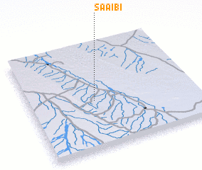 Places with similar names to Sa‘aibi, Saudi Arabia ::
Disclaimer :: Information on this page comes without warranty of any kind |
||
|
Where is Sa‘aibi? Elevation and coordinates ::
Latitude (lat): 25°28'0"N Longitude (lon): 44°24'0"E
Elevation (approx.): 687m (map arrows pan, magnifying glasses zoom) |
||
|
Visiting Sa‘aibi? Hotel/Accommodation ::
Book a hotel in Sa‘aibi Travel Guide ::
rental cars ::
car rental offers GPS waypoint ::
download a GPX waypoint (PoI) of Sa‘aibi for your GPS receiver
|
||