|
search place name
|
||
Umm Hamlā (Saudi Arabia)Umm Hamlā is a town in Saudi Arabia. An overview map of the region around Umm Hamlā is displayed below.
regional and 3d topo map of Umm Hamlā, Saudi Arabia ::

Umm Hamlā airports ::
The nearest airport is JED - Jeddah King Abdulaziz Intl, located 56.1 km west of Umm Hamlā.
Other airports nearby include TIF - Taif (89.3 km east), ABT - El-baha Al Baha (248.3 km south east), Nearby towns ::
Nuqaybat ash Shumaysī (0.9km west) //
Al Fayḑ (1.9km south west) //
Al Jumūm (2.0km north) //
Ash Shuyūkh (2.0km south west) //
Ash Shumaysī (2.0km south west) //
Abū Shu‘ayb (2.1km south) //
Al Qirshān (3.4km south) //
Daff Zaynī (3.8km south) //
Abū ‘Urwah (5.5km north) //
Al Ḩasanīyah (5.6km north) //
Ad Dawḩ al Kabīr (5.9km south west) //
Az̧ Z̧ahārīyah (6.1km north east) //
Al Yāqūtīyah (7.0km south west) //
Al Mundassah (7.0km north east) //
Daff Khuzā‘ah (7.3km south) //
Burqah (7.9km north) //
Ad Dawḩ aş Şaghīr (7.7km south west) //
‘Ayn Shams (8.7km north east) //
Al Jadīdah (9.6km south west) //
Aş Şamd ash Shamālī (10.3km north east) //
Al Barābir (10.8km south west) //
Al Ashrāf (11.5km south west) //
[all distances 'as the bird flies' and approximate] 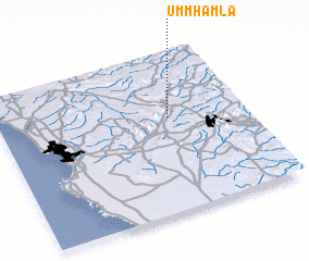 Places with similar names to Umm Hamlā, Saudi Arabia :: Disclaimer :: Information on this page comes without warranty of any kind |
||
|
Where is Umm Hamlā? Elevation and coordinates ::
Latitude (lat): 21°36'0"N Longitude (lon): 39°41'30"E
Elevation (approx.): 194m (map arrows pan, magnifying glasses zoom) |
||
|
Visiting Umm Hamlā? Hotel/Accommodation ::
Book a hotel in Umm Hamlā Travel Guide ::
rental cars ::
car rental offers GPS waypoint ::
download a GPX waypoint (PoI) of Umm Hamlā for your GPS receiver
|
||