|
search place name
|
||
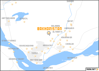
Bakhoristan (Surxondaryo, Uzbekistan)Bakhoristan is a town in the Surxondaryo region of Uzbekistan. An overview map of the region around Bakhoristan is displayed below.
regional and 3d topo map of Bakhoristan, Uzbekistan ::
Bakhoristan airports ::
The nearest airport is MZR - Mazar-i-sharif Mazar I Sharif, located 66.0 km south of Bakhoristan.
Other airports nearby include UND - Kunduz Konduz (157.3 km south east), DYU - Dushanbe (191.2 km north east), Nearby towns ::
Salavat (1.5km south east) //
Chegara (1.9km south) //
Gulistan (2.5km south east) //
Oltaaryk (2.5km east) //
(( Saliabad )) (3.2km north east) //
Yangiariq (3.6km south east) //
Kyzylbay (4.1km south east) //
Avtogarazh (4.1km south east) //
Manguzar (4.8km south) //
Kaptarkhana (4.8km south east) //
Komsomol (4.9km east) //
(( Babamurk-Sarmez )) (5.0km east) //
Urtaaryk (5.0km east) //
Yangikishlak (6.3km south) //
Stantsiya Termez (6.0km south west) //
Charvador (5.9km south east) //
Uzbekistan (6.7km south) //
Kakhramon (5.6km east) //
Komendatura (6.6km south east) //
Karakhon (6.3km east) //
(( Barinchi-Garma )) (7.3km south west) //
Chkalov (7.6km south east) //
Dzheyrankhana (7.6km north east) //
(( Sayat )) (7.7km north east) //
Termiz (8.9km south west) //
(( Yekinchi-Garma )) (8.5km south west) //
Akhunbabayev (8.7km south east) //
Baynalminal (9.0km south west) //
[all distances 'as the bird flies' and approximate] 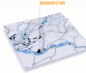 Places with similar names to Bakhoristan, Uzbekistan :: Disclaimer :: Information on this page comes without warranty of any kind |
||
|
Where is Bakhoristan? Elevation and coordinates ::
Latitude (lat): 37°17'40"N Longitude (lon): 67°19'39"E
Elevation (approx.): 315m (map arrows pan, magnifying glasses zoom) |
||
|
Visiting Bakhoristan? Hotel/Accommodation ::
Book a hotel in Bakhoristan Travel Guide ::
Buy a travel guide for Uzbekistan rental cars ::
car rental offers GPS waypoint ::
download a GPX waypoint (PoI) of Bakhoristan for your GPS receiver
|
||