|
search place name
|
||
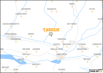
Changir (Uzbekistan)Changir is a town in Uzbekistan. An overview map of the region around Changir is displayed below.
regional and 3d topo map of Changir, Uzbekistan ::
Changir airports ::
The nearest airport is SKD - Samarkand, located 100.2 km south east of Changir.
Other airports nearby include BHK - Bukhara (129.1 km west), Nearby towns ::
Maylyk (2.3km north west) //
Kukchi (4.0km south) //
Karacha (3.4km south east) //
Shuluk-Tepa (5.7km south) //
Turkman (5.6km south east) //
Saray (5.7km west) //
Durman (7.0km south west) //
Katta-Say (6.8km north east) //
Khatyrchi (7.9km south) //
Yangirabod (8.1km south) //
[all distances 'as the bird flies' and approximate] 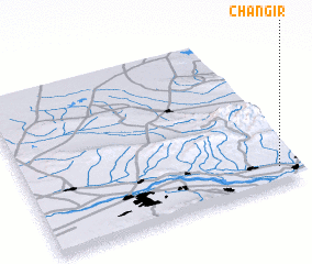 Places with similar names to Changir, Uzbekistan ::
// Chëngërë (RU)
// Changeri (IN)
// Channagiri (IN)
// Cianjur (ID)
// Sianjur (ID)
// Siongiroi (KE)
// Shāh Nājer (IR)
// Shanjūr (IR)
// Shengerī (IR)
// Shīn Gerā (IR)
Disclaimer :: Information on this page comes without warranty of any kind |
||
|
Where is Changir? Elevation and coordinates ::
Latitude (lat): 40°6'0"N Longitude (lon): 65°56'0"E
Elevation (approx.): 436m (map arrows pan, magnifying glasses zoom) |
||
|
Visiting Changir? Hotel/Accommodation ::
Book a hotel in Changir Travel Guide ::
Buy a travel guide for Uzbekistan rental cars ::
car rental offers GPS waypoint ::
download a GPX waypoint (PoI) of Changir for your GPS receiver
|
||