|
search place name
|
||
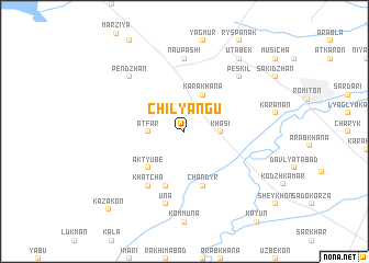
Chilyangu (Uzbekistan)Chilyangu is a town in Uzbekistan. An overview map of the region around Chilyangu is displayed below.
regional and 3d topo map of Chilyangu, Uzbekistan ::
Chilyangu airports ::
The nearest airport is BHK - Bukhara, located 23.2 km south east of Chilyangu.
Nearby towns ::
Sar-i-Pastan (1.9km north) //
Decha (2.3km north west) //
Khasi (2.8km east) //
Atfar (2.8km west) //
Miyonsaroy (3.4km north west) //
Kara-Khana (4.0km north) //
Ak-Tyube (4.7km south west) //
Chandyr (5.7km south) //
Chekir (5.7km south) //
Khatcha (6.2km south west) //
Naupashi (7.4km north) //
Una (7.5km south) //
Peskilʼ (7.0km north east) //
Pendzhan (7.0km north west) //
Utabek (8.6km north east) //
Kazakon (9.9km south west) //
[all distances 'as the bird flies' and approximate]  Places with similar names to Chilyangu, Uzbekistan ::
// Shalayang (MM)
// Shaluyang (MM)
// Chilyango (ZM)
// Ch'ŏllyŏng (KP)
// Shiliying (CN)
// Shiluoyang (CN)
Disclaimer :: Information on this page comes without warranty of any kind |
||
|
Where is Chilyangu? Elevation and coordinates ::
Latitude (lat): 39°54'0"N Longitude (lon): 64°16'0"E
Elevation (approx.): 221m (map arrows pan, magnifying glasses zoom) |
||
|
Visiting Chilyangu? Hotel/Accommodation ::
Book a hotel in Chilyangu Travel Guide ::
Buy a travel guide for Uzbekistan rental cars ::
car rental offers GPS waypoint ::
download a GPX waypoint (PoI) of Chilyangu for your GPS receiver
|
||