|
search place name
|
||
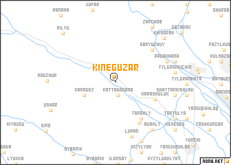
Kineguzar (Surxondaryo, Uzbekistan)Kineguzar is a town in the Surxondaryo region of Uzbekistan. An overview map of the region around Kineguzar is displayed below.
regional and 3d topo map of Kineguzar, Uzbekistan ::
Kineguzar airports ::
The nearest airport is DYU - Dushanbe, located 90.6 km east of Kineguzar.
Other airports nearby include SKD - Samarkand (157.0 km north west), MZR - Mazar-i-sharif Mazar I Sharif (198.7 km south), UND - Kunduz Konduz (219.8 km south east), Nearby towns ::
Katta-Dagana (2.1km south) //
Kara-Gez (4.5km south west) //
Kara-Shuluk (5.7km south east) //
Tarakly (6.7km south east) //
Kairma (7.2km south east) //
Sary-Dzhuy (7.1km north east) //
Padakhana (7.3km north east) //
Lupan (9.0km south) //
Avakly (9.0km south east) //
Khisarak (9.4km north east) //
Nilyu (10.4km north west) //
[all distances 'as the bird flies' and approximate] 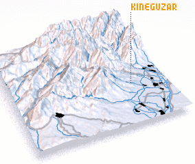 Places with similar names to Kineguzar, Uzbekistan ::
// Kings Row (US)
// Kangozero (RU)
// Kynkeser (RU)
// Gāngsār (BD)
// Kanaksār (BD)
// Kanaksri (BD)
// Kunikusura (BD)
// Ganégoussarou (BJ)
// Gāngāsara (IN)
// Kengzhyra (KZ)
Disclaimer :: Information on this page comes without warranty of any kind |
||
|
Where is Kineguzar? Elevation and coordinates ::
Latitude (lat): 38°26'8"N Longitude (lon): 67°47'46"E
Elevation (approx.): 756m (map arrows pan, magnifying glasses zoom) |
||
|
Visiting Kineguzar? Hotel/Accommodation ::
Book a hotel in Kineguzar Travel Guide ::
Buy a travel guide for Uzbekistan rental cars ::
car rental offers GPS waypoint ::
download a GPX waypoint (PoI) of Kineguzar for your GPS receiver
|
||