|
search place name
|
||
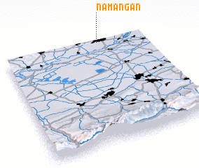
Namangan (Namangan, Uzbekistan)Namangan is a town in the Namangan region of Uzbekistan. An overview map of the region around Namangan is displayed below.
regional and 3d topo map of Namangan, Uzbekistan ::

Namangan airports ::
The nearest airport is OSS - Osh, located 103.9 km south east of Namangan.
Other airports nearby include DMB - Dzhambul Taraz (208.7 km north), Nearby towns ::
 Places with similar names to Namangan, Uzbekistan ::
// Nammawngon (MM)
// Nam-maw-ngün (MM)
// Nammawngun (MM)
// Nam-ngawn (MM)
// Nambangan (ID)
// Namangan (UZ)
// Namong-ni (KP)
// Namboongan (PH)
// Numangan (PH)
// Nam Ngạn (VN)
Disclaimer :: Information on this page comes without warranty of any kind |
||
|
Where is Namangan? Elevation and coordinates ::
Latitude (lat): 40°59'43"N Longitude (lon): 71°40'21"E
Elevation (approx.): 434m (map arrows pan, magnifying glasses zoom) |
||
|
Visiting Namangan? Hotel/Accommodation ::
Book a hotel in Namangan Travel Guide ::
Buy a travel guide for Uzbekistan rental cars ::
car rental offers GPS waypoint ::
download a GPX waypoint (PoI) of Namangan for your GPS receiver
|
||