|
search place name
|
||
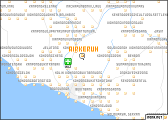
Air Keruh (Melaka, Malaysia)Air Keruh is a town in the Melaka region of Malaysia. An overview map of the region around Air Keruh is displayed below.
regional and 3d topo map of Air Keruh, Malaysia ::
nearby GPS traces from timatio ::
Air Keruh airports ::
The nearest airport is MKZ - Malacca, located 3.6 km west of Air Keruh.
Other airports nearby include KUL - Kuala Lumpur Intl (82.9 km north west), DUM - Dumai Pinang Kampai (119.3 km south west), JHB - Johor Bahru Sultan Ismail (169.0 km south east), KUA - Kuantan (196.0 km north east), Nearby towns ::
Kampong Tualang (2.6km north west) //
Kampong Gangsa (2.6km north west) //
Kampong Sungai Putat (2.6km south west) //
Kampong Tengah (2.6km south west) //
Kampong Pulau Samak (3.7km west) //
Kampong Telok (3.7km south) //
Bukit Paya Ikan (3.7km south) //
Kampong Bukit Beruang (3.7km south) //
Kampong Pulau (4.1km north west) //
Kampong Bukit Balai (4.1km north west) //
Batu Berendam (4.1km south west) //
Kampong Pengkalan Batu (4.1km south west) //
Kampong Balik Hutan (4.1km south east) //
Kampong Kerubong (5.2km north west) //
Kampong Padang Siapong (5.2km north west) //
Kampong Sungai Badau (5.2km north west) //
Kampong Sarang Helang (5.2km south west) //
Kampong Bachang (5.2km south west) //
Kampong Pengkalan Badak (5.2km south east) //
Kampong Padang Jambu (5.6km south) //
Durian Tunggal (5.6km north) //
Kampong Padang Kerbau (5.6km north) //
Kampong Padang Keladi (5.6km north) //
Kampong Bukit Baru (5.6km south) //
Kampong Gapam (5.6km east) //
Kampong Tampoi (5.9km west) //
Kampong Bukit Baru Dalam (5.9km south) //
Kampong Tengah (5.9km north) //
Kampong Peringgit (5.9km south) //
[all distances 'as the bird flies' and approximate]  Places with similar names to Air Keruh, Malaysia ::
Disclaimer :: Information on this page comes without warranty of any kind |
||
|
Where is Air Keruh? Elevation and coordinates ::
Latitude (lat): 2°16'0"N Longitude (lon): 102°17'0"E
Elevation (approx.): 12m (map arrows pan, magnifying glasses zoom) |
||
|
Visiting Air Keruh? Hotel/Accommodation ::
Book a hotel in Air Keruh Travel Guide ::
Buy a travel guide for Malaysia rental cars ::
car rental offers GPS waypoint ::
download a GPX waypoint (PoI) of Air Keruh for your GPS receiver
|
||