|
search place name
|
||
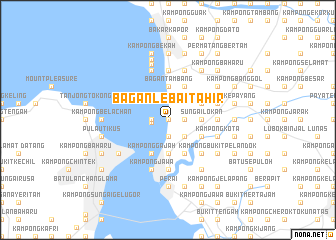
Bagan Lebai Tahir (Pulau Pinang, Malaysia)Bagan Lebai Tahir is a town in the Pulau Pinang region of Malaysia. An overview map of the region around Bagan Lebai Tahir is displayed below.
regional and 3d topo map of Bagan Lebai Tahir, Malaysia ::
Bagan Lebai Tahir airports ::
The nearest airport is PEN - Penang Intl, located 20.6 km south west of Bagan Lebai Tahir.
Other airports nearby include AOR - Alor Setar Sultan Abdul Halim (81.8 km north), LGK - Pulau Langkawi Intl (121.3 km north west), IPH - Ipoh Sultan Azlan Shah (125.3 km south east), HDY - Songkhla Hat Yai Intl (164.0 km north), Nearby towns ::
Kampong Bagan Ajam (0.0km north) //
Permatang Tengah (0.0km north) //
Ajam Bagan (1.8km west) //
Kampong Bagan Jermal (1.9km south) //
Kampong Bagan Lalang (1.9km south) //
Kampong Kubang Buaya (1.9km south) //
Permatang Tok Jaya (1.8km east) //
Pokok Keras (1.8km east) //
Maklom (1.8km east) //
Sungai Puyu (1.8km east) //
Telok Behang (1.9km west) //
Sama Gagah Dalam (2.6km south east) //
Permatang Lanjut (2.6km south east) //
Kampong Sama Gagah (2.6km south east) //
Mak Mandin (3.7km south) //
Telok Ayer Tawar (3.7km north) //
Kampong Simpah (3.7km south) //
Kampong Baharu (3.7km south) //
Kampong Setol (3.7km north) //
Kampung Teluk Air Tawar (3.7km north) //
Kampong Paya (3.7km south) //
Bagan Tambang (3.7km north) //
Sungai Lokan (3.7km east) //
Kampong Telok (3.7km east) //
Permatang Che' Tak (3.7km east) //
Kampong Bengga (4.1km south west) //
Kampong Bagan Tuan Kechil (4.1km south west) //
Bagan Tuan Kechil (4.1km south west) //
Kampong Gajah (4.1km south west) //
[all distances 'as the bird flies' and approximate] 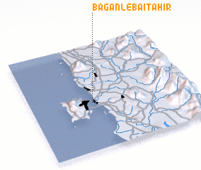 Places with similar names to Bagan Lebai Tahir, Malaysia :: Disclaimer :: Information on this page comes without warranty of any kind |
||
|
Where is Bagan Lebai Tahir? Elevation and coordinates ::
Latitude (lat): 5°27'0"N Longitude (lon): 100°23'0"E
Elevation (approx.): 9m (map arrows pan, magnifying glasses zoom) |
||
|
Visiting Bagan Lebai Tahir? Hotel/Accommodation ::
Book a hotel in Bagan Lebai Tahir Travel Guide ::
Buy a travel guide for Malaysia rental cars ::
car rental offers GPS waypoint ::
download a GPX waypoint (PoI) of Bagan Lebai Tahir for your GPS receiver
|
||