|
search place name
|
||
Bandar (Malaysia)Bandar is a town in Malaysia. An overview map of the region around Bandar is displayed below.
regional and 3d topo map of Bandar, Malaysia ::

Bandar airports ::
The nearest airport is KUL - Kuala Lumpur Intl, located 33.5 km south east of Bandar.
Other airports nearby include MKZ - Malacca (112.8 km south east), DUM - Dumai Pinang Kampai (139.0 km south), IPH - Ipoh Sultan Azlan Shah (191.9 km north), KUA - Kuantan (221.5 km north east), Nearby towns ::
Kampong Ayer Tawar (1.9km south) //
Sungai Ingat (1.9km south) //
Kampong Sungai Bumbun (2.6km south west) //
Kampong Tanah Raja (2.6km south east) //
Langat (2.9km south east) //
Permatang Pasir (3.7km south) //
Kampong Jelutong (3.7km south) //
Kampong Sungai Sialang (4.1km south west) //
Kampong Sungai Mata (4.1km south west) //
Segenting (4.1km north east) //
Jugra Lama (4.1km south west) //
Kampong Katong (4.1km south east) //
Chodoi (4.1km south east) //
Kampong Sungai Buaya (4.1km south east) //
Kampong Bandang (5.6km south) //
Pulau Nyatoh (5.6km south) //
Gelanggang Buaya (5.6km south) //
Kampong Sungai Rambai (5.9km east) //
Rantau Panjang (5.9km east) //
Kampong Telok Mengkuang (5.9km north) //
Jugra (5.9km south) //
Buaya Sungai (5.9km east) //
Kampong Sungai Raba (5.9km south) //
Kampong Sungai Tampoi (5.9km south) //
Kampong Sungai Rambai (6.7km south west) //
Teluk Panglima Garang (6.7km north east) //
Kampong Beting Tengah (7.4km north) //
Kampong Permatang Buah (7.4km south) //
Kampong Sungai Hantu (7.4km south) //
[all distances 'as the bird flies' and approximate] 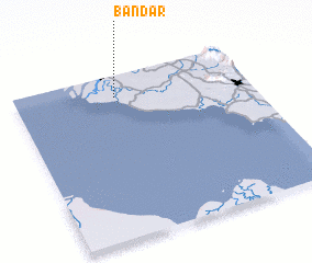 Places with similar names to Bandar, Malaysia ::
// Beni Idder (MA)
// Beni Idir (MA)
// Beni Idir (MA)
// Bou Antar (MA)
// Boû Ouentere (MA)
// Bandīra (ET)
// Bander (ET)
// Bañadero (PH)
// Bañadero (PH)
// Bañadero (PH)
Disclaimer :: Information on this page comes without warranty of any kind |
||
|
Where is Bandar? Elevation and coordinates ::
Latitude (lat): 2°52'0"N Longitude (lon): 101°26'0"E
Elevation (approx.): 10m (map arrows pan, magnifying glasses zoom) |
||
|
Visiting Bandar? Hotel/Accommodation ::
Book a hotel in Bandar Travel Guide ::
Buy a travel guide for Malaysia rental cars ::
car rental offers GPS waypoint ::
download a GPX waypoint (PoI) of Bandar for your GPS receiver
|
||