|
search place name
|
||
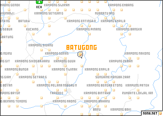
Batu Gong (Sarawak, Malaysia)Batu Gong is a town in the Sarawak region of Malaysia. An overview map of the region around Batu Gong is displayed below.
regional and 3d topo map of Batu Gong, Malaysia ::
Batu Gong airports ::
The nearest airport is KCH - Kuching Intl, located 16.2 km north west of Batu Gong.
Other airports nearby include SQC - Sintang Susilo (184.8 km south east), SBW - Sibu (199.0 km north east), PNK - Pontianak Supadio (203.2 km south west), Nearby towns ::
Kampong Endap (1.9km north) //
Kampong Kangka (1.9km north) //
Kampong Batu Gong (1.9km south) //
Kampong Beradau (2.6km north west) //
Siburan (3.7km west) //
Kampong Duuh (4.1km south west) //
Kampong Masan (4.1km south west) //
Kampong Siga (4.1km south west) //
Kampong Tijirak (5.2km south west) //
Nineteenth Mile Bazaar (5.2km south west) //
Kampong Empila (5.2km south east) //
Kampong Doras (5.6km west) //
Kampong Pinang (5.9km north) //
Kampong Raeh (6.7km south east) //
Kampong Soh (6.7km south east) //
Kampong Merang (6.7km south east) //
Kampong Entingan (7.4km north) //
Kampong Nangka (7.4km north) //
Kampong Sekeduk Baharu (7.6km west) //
Fifteenth Mile Bazaar (7.6km west) //
Kampong Langsat (7.6km north) //
Kampong Maranek (7.6km north) //
Kampong Siburan (7.6km west) //
Kampong Pelaman Tabiyan Patung (7.9km south west) //
Kampong Seruit (7.9km south east) //
Kampong Ulu Merang (7.9km south east) //
Kampong Turong (7.9km south east) //
Kampong Mundai (8.3km south west) //
Kampong Menjau (9.3km south west) //
[all distances 'as the bird flies' and approximate] 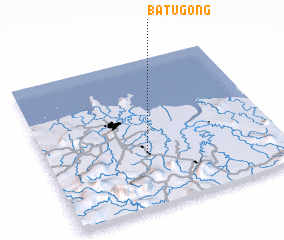 Places with similar names to Batu Gong, Malaysia ::
Disclaimer :: Information on this page comes without warranty of any kind |
||
|
Where is Batu Gong? Elevation and coordinates ::
Latitude (lat): 1°22'0"N Longitude (lon): 110°26'0"E
Elevation (approx.): 14m (map arrows pan, magnifying glasses zoom) |
||
|
Visiting Batu Gong? Hotel/Accommodation ::
Book a hotel in Batu Gong Travel Guide ::
Buy a travel guide for Malaysia rental cars ::
car rental offers GPS waypoint ::
download a GPX waypoint (PoI) of Batu Gong for your GPS receiver
|
||