|
search place name
|
||
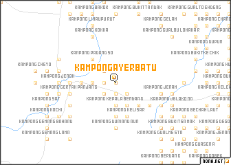
Kampong Ayer Batu (Kelantan, Malaysia)Kampong Ayer Batu is a town in the Kelantan region of Malaysia. An overview map of the region around Kampong Ayer Batu is displayed below.
regional and 3d topo map of Kampong Ayer Batu, Malaysia ::
Kampong Ayer Batu airports ::
The nearest airport is KBR - Kota Bahru Sultan Ismail Petra, located 51.6 km north east of Kampong Ayer Batu.
Other airports nearby include NAW - Narathiwat (79.8 km north), TGG - Kuala Terengganu Sultan Mahmud (135.4 km east), PAN - Pattani (138.5 km north west), IPH - Ipoh Sultan Azlan Shah (170.2 km south west), Nearby towns ::
Kampong Tok Chek Ngal (0.0km north) //
Kampong Rotan Tawar (1.9km south) //
Kampong Banggol Jering (1.9km south) //
Kampong Penglima Bayu (1.9km south) //
Kampong Bendang Keladi (1.9km south) //
Kampung Jeduk (1.8km west) //
Kampong Bechah Butir Nangka (1.8km west) //
Kampong Ayer Asahan (2.6km south east) //
Kampong Bedah (2.6km south east) //
Kampong Asahan Hilir (2.6km south east) //
Kampong Gual (2.6km south west) //
Kampong Mak Jitan (2.6km north west) //
Kampong Bukit Berapit (3.7km south) //
Kampong Kepala Bendang (3.7km south) //
Kampong Lawang (3.7km south) //
Kampong Banggol Yek (3.7km west) //
Kampong Ayer Merah (4.1km south east) //
Kampong Batu Gajah (4.1km south east) //
Kampong Kelewek (4.1km south east) //
Kampong Pelaing (4.1km south east) //
Kampong Asahan Hulu (5.2km south east) //
Kampong Padangso (5.2km north west) //
Kampong Mak Terak (5.6km south) //
Kampong Siam (5.6km south) //
Kampung Nibung (5.5km west) //
Kampong Tilam (5.5km west) //
Kampong Durian Daun (5.9km south) //
Kampong Kelisar (5.9km south) //
Kampong Repoh (5.9km south) //
[all distances 'as the bird flies' and approximate] 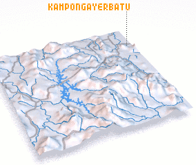 Places with similar names to Kampong Ayer Batu, Malaysia :: Disclaimer :: Information on this page comes without warranty of any kind |
||
|
Where is Kampong Ayer Batu? Elevation and coordinates ::
Latitude (lat): 5°50'0"N Longitude (lon): 101°58'0"E
Elevation (approx.): 27m (map arrows pan, magnifying glasses zoom) |
||
|
Visiting Kampong Ayer Batu? Hotel/Accommodation ::
Book a hotel in Kampong Ayer Batu Travel Guide ::
Buy a travel guide for Malaysia rental cars ::
car rental offers GPS waypoint ::
download a GPX waypoint (PoI) of Kampong Ayer Batu for your GPS receiver
|
||