|
search place name
|
||
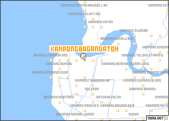
Kampong Bagan Datoh (Perak, Malaysia)Kampong Bagan Datoh is a town in the Perak region of Malaysia. An overview map of the region around Kampong Bagan Datoh is displayed below.
regional and 3d topo map of Kampong Bagan Datoh, Malaysia ::
Kampong Bagan Datoh airports ::
The nearest airport is IPH - Ipoh Sultan Azlan Shah, located 74.1 km north east of Kampong Bagan Datoh.
Other airports nearby include PEN - Penang Intl (155.1 km north), KUL - Kuala Lumpur Intl (172.4 km south east), MKZ - Malacca (251.8 km south east), Nearby towns ::
Pasang Api (NaNkm north) //
Kampong Pasang Api (NaNkm north) //
Bagan Datuk (1.8km east) //
Bagan Datoh (1.8km east) //
Kampong Sungai Nipah Baroh (1.8km west) //
Kampong Haji Dollah (1.8km west) //
Kampong Lubok Lima (3.7km east) //
Kampong Permatang Kunda (3.7km south) //
Kampung Sungai Ular (3.7km west) //
Kampong Sungai Balai Baroh (3.7km west) //
Kampung Sungai Nipah (3.7km west) //
Kampong Sungai Balai Darat (5.2km south west) //
Kampung Sungai Ular (5.5km west) //
Kampong Sungai Betul (5.5km west) //
Kampung Burong (5.8km west) //
Simpang Tiga Rungkup (5.9km south) //
Kampong Sungai Nipah Darat (5.9km south) //
Rungkup Kecil (6.7km south west) //
Simpang Empat Rungkup (6.7km south west) //
Bagan Sungai Burong (7.4km west) //
Kampung Pasir Blanda (7.4km north) //
Selekoh (7.6km south) //
Kampong Sungai Tiga Darat (7.6km south) //
Kampung Pasir Belanda (7.6km north) //
Kampong Sungai Lanchang (7.9km south west) //
Bagan Sangka Lubok (8.3km north east) //
Kampong Kayan (8.3km north east) //
Bagan Sungai Rungkup (8.3km south west) //
[all distances 'as the bird flies' and approximate]  Places with similar names to Kampong Bagan Datoh, Malaysia :: Disclaimer :: Information on this page comes without warranty of any kind |
||
|
Where is Kampong Bagan Datoh? Elevation and coordinates ::
Latitude (lat): 3°59'0"N Longitude (lon): 100°46'0"E
Elevation (approx.): 11m (map arrows pan, magnifying glasses zoom) |
||
|
Visiting Kampong Bagan Datoh? Hotel/Accommodation ::
Book a hotel in Kampong Bagan Datoh Travel Guide ::
Buy a travel guide for Malaysia rental cars ::
car rental offers GPS waypoint ::
download a GPX waypoint (PoI) of Kampong Bagan Datoh for your GPS receiver
|
||