|
search place name
|
||
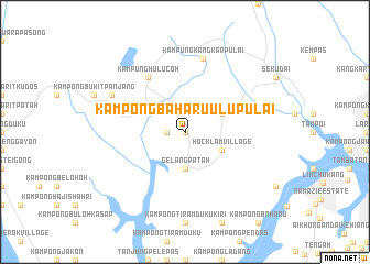
Kampong Baharu Ulu Pulai (Johor, Malaysia)Kampong Baharu Ulu Pulai is a town in the Johor region of Malaysia. An overview map of the region around Kampong Baharu Ulu Pulai is displayed below.
regional and 3d topo map of Kampong Baharu Ulu Pulai, Malaysia ::
Kampong Baharu Ulu Pulai airports ::
The nearest airport is JHB - Johor Bahru Sultan Ismail, located 19.9 km north east of Kampong Baharu Ulu Pulai.
Other airports nearby include XSP - Singapore Seletar (32.5 km east), QPG - Paya Lebar (38.8 km east), SIN - Singapore Changi Intl (48.1 km east), MKZ - Malacca (171.4 km north west), Nearby towns ::
Leong Bee Village (0.0km north) //
Kampong Pulai (1.9km west) //
Gelang Patah (3.7km south) //
Hock Lam Village (4.1km south east) //
Lima Kedai (4.1km north east) //
Kampung Hulu Coh (6.7km north west) //
Kampung Kangkar Pulai (7.6km north) //
Pekan Nanas (8.3km north west) //
[all distances 'as the bird flies' and approximate]  Places with similar names to Kampong Baharu Ulu Pulai, Malaysia :: Disclaimer :: Information on this page comes without warranty of any kind |
||
|
Where is Kampong Baharu Ulu Pulai? Elevation and coordinates ::
Latitude (lat): 1°29'0"N Longitude (lon): 103°35'0"E
Elevation (approx.): 14m (map arrows pan, magnifying glasses zoom) |
||
|
Visiting Kampong Baharu Ulu Pulai? Hotel/Accommodation ::
Book a hotel in Kampong Baharu Ulu Pulai Travel Guide ::
Buy a travel guide for Malaysia rental cars ::
car rental offers GPS waypoint ::
download a GPX waypoint (PoI) of Kampong Baharu Ulu Pulai for your GPS receiver
|
||