|
search place name
|
||
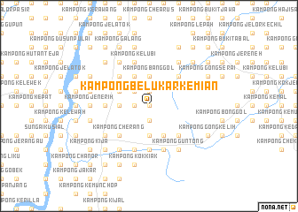
Kampong Belukar Kemian (Kelantan, Malaysia)Kampong Belukar Kemian is a town in the Kelantan region of Malaysia. An overview map of the region around Kampong Belukar Kemian is displayed below.
regional and 3d topo map of Kampong Belukar Kemian, Malaysia ::
Kampong Belukar Kemian airports ::
The nearest airport is KBR - Kota Bahru Sultan Ismail Petra, located 40.7 km north of Kampong Belukar Kemian.
Other airports nearby include NAW - Narathiwat (98.5 km north west), TGG - Kuala Terengganu Sultan Mahmud (103.6 km south east), PAN - Pattani (164.5 km north west), IPH - Ipoh Sultan Azlan Shah (188.5 km south west), Nearby towns ::
Kampong Dewan Kechil (0.0km north) //
Kampong Dewan Besar (0.0km north) //
Kampong Telaga Tujoh (0.0km north) //
Kampong Batu Berdiri (1.9km south) //
Kampong Banggol Sering (1.9km north) //
Kampong Takil (1.8km west) //
Kampong Gendang Lima (1.8km west) //
Kampong Kemahang (2.6km north west) //
Kampong Pankal Jetas (2.6km north west) //
Kampong Labok (2.6km north west) //
Bukit Lada (3.7km south) //
Kampong Banggol (3.7km north) //
Kampong Tok Midong (3.7km west) //
Kampong Bukit Belah (3.7km west) //
Kampong Banggol Judah (4.1km south east) //
Kampong Tualang Kudong (4.1km north west) //
Kampong Pangkal Kerdas (4.1km north west) //
Kampong Rengas (4.1km north west) //
Kampong Nerang (4.1km north west) //
Kampong Takil Luar (4.1km north west) //
Kampong Bunut Tok Mak Teh (4.1km north west) //
Kampong Takil Dalam (4.1km north west) //
Kampong Batu (4.1km north west) //
Kampong Wek (4.1km north west) //
Kampong Bunui Tok Mek Teh (4.1km north west) //
Kampong Siam (5.2km north east) //
Kampong Sungai Ayer Belaga (5.2km south east) //
Kampong Cherang (5.2km south west) //
Kampong Tok Bok (5.2km north west) //
[all distances 'as the bird flies' and approximate] 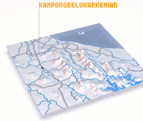 Places with similar names to Kampong Belukar Kemian, Malaysia :: Disclaimer :: Information on this page comes without warranty of any kind |
||
|
Where is Kampong Belukar Kemian? Elevation and coordinates ::
Latitude (lat): 5°48'0"N Longitude (lon): 102°16'0"E
Elevation (approx.): 51m (map arrows pan, magnifying glasses zoom) |
||
|
Visiting Kampong Belukar Kemian? Hotel/Accommodation ::
Book a hotel in Kampong Belukar Kemian Travel Guide ::
Buy a travel guide for Malaysia rental cars ::
car rental offers GPS waypoint ::
download a GPX waypoint (PoI) of Kampong Belukar Kemian for your GPS receiver
|
||