|
search place name
|
||
Kampong Bukit Kekabu (Melaka, Malaysia)Kampong Bukit Kekabu is a town in the Melaka region of Malaysia. An overview map of the region around Kampong Bukit Kekabu is displayed below.
regional and 3d topo map of Kampong Bukit Kekabu, Malaysia ::

Kampong Bukit Kekabu airports ::
The nearest airport is MKZ - Malacca, located 23.9 km south east of Kampong Bukit Kekabu.
Other airports nearby include KUL - Kuala Lumpur Intl (56.6 km north west), DUM - Dumai Pinang Kampai (116.1 km south west), KUA - Kuantan (194.3 km north east), JHB - Johor Bahru Sultan Ismail (194.5 km south east), Nearby towns ::
Kampong Sungai Jerneh (1.9km north) //
Solok Ayer Limau Nipis (1.9km south) //
Kampong Ramuan China Kechil (2.6km north west) //
Kampong Baharu (2.6km north east) //
Kampong Lendu (2.6km north east) //
Solok Mempedal Ayam (2.6km north east) //
Kampong Batu Alang (2.6km north east) //
Ramuan China Besar (2.6km south west) //
Kampong Paya Lebar (3.7km west) //
Kampong Titian Bintangor (3.7km north) //
Kampong Kubang Badak (3.7km north) //
Kampong Solok Uban (3.7km east) //
Berisu (4.1km north east) //
Kampong Tengah (4.1km north east) //
Kampong Berisu (4.1km north east) //
Kampong Baharu (4.1km north west) //
Kampong Ramuan China Besar (4.1km south west) //
Kampong Sungai Siput (4.1km north east) //
Kampong Lubok Buntal (4.1km north east) //
Kampong Rantau Panjang (4.1km south east) //
Lubuk Cina (5.2km north west) //
Kampong Telok Berembang (5.2km north west) //
Pengkalan Paoh (5.2km north west) //
Kampong Lubok Redan (5.2km south west) //
Kampong Ayer Ponggai (5.2km south east) //
Solok Chambang (5.6km south) //
Kampong Paya Rumput (5.6km south) //
Kampong Tengah (5.6km south) //
Kampong Titian Akar (5.6km north) //
[all distances 'as the bird flies' and approximate] 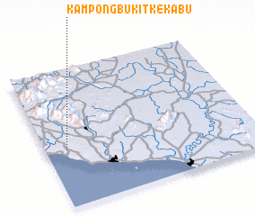 Places with similar names to Kampong Bukit Kekabu, Malaysia :: Disclaimer :: Information on this page comes without warranty of any kind |
||
|
Where is Kampong Bukit Kekabu? Elevation and coordinates ::
Latitude (lat): 2°25'0"N Longitude (lon): 102°6'0"E
Elevation (approx.): 65m (map arrows pan, magnifying glasses zoom) |
||
|
Visiting Kampong Bukit Kekabu? Hotel/Accommodation ::
Book a hotel in Kampong Bukit Kekabu Travel Guide ::
Buy a travel guide for Malaysia rental cars ::
car rental offers GPS waypoint ::
download a GPX waypoint (PoI) of Kampong Bukit Kekabu for your GPS receiver
|
||