|
search place name
|
||
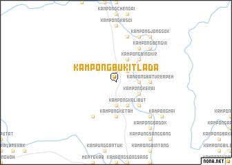
Kampong Bukit Lada (Pahang, Malaysia)Kampong Bukit Lada is a town in the Pahang region of Malaysia. An overview map of the region around Kampong Bukit Lada is displayed below.
regional and 3d topo map of Kampong Bukit Lada, Malaysia ::
Kampong Bukit Lada airports ::
The nearest airport is KUA - Kuantan, located 93.8 km east of Kampong Bukit Lada.
Other airports nearby include KUL - Kuala Lumpur Intl (120.5 km south west), MKZ - Malacca (148.5 km south), KTE - Kerteh (155.4 km north east), IPH - Ipoh Sultan Azlan Shah (178.9 km north west), Nearby towns ::
Kampong Guntong (1.9km north) //
Kampung Tekal (2.6km north east) //
Kampong Titi Keladan (2.6km north east) //
Kampong Tanjong Kabong (2.6km north east) //
Kampong Telok (2.6km north east) //
Kampong Taram (3.7km south) //
Kampong Batu Chawan (3.7km east) //
Kampong Pengkalan Rasau (4.1km north east) //
Kampong Bukit Panchor (4.1km south east) //
Kampung Kuala Kerdau (4.1km south east) //
Kampong Kelibut (4.1km south east) //
Kampong Machang Manis (4.1km south east) //
Kampong Kerai (4.1km south east) //
Kampong Lipat Kajang (4.1km south east) //
Kampong Tanjong Keling (4.1km south east) //
Kampong Nuar (4.1km south east) //
Kampong Dingkir (5.2km north east) //
Kampong Tamping (5.2km north east) //
Kampong Purum (5.2km south east) //
Kampong Batu Rempeh (5.5km east) //
Kampong Paya Ara (5.6km south) //
Kampong Ketam (5.6km south) //
Kampong Paya Sat (6.7km south west) //
Kampong Sungai Mas (6.7km north east) //
Kampong Lanjut (7.6km north) //
Kampong Tanjong Pasir (7.9km north east) //
Kampong Badak (7.9km north east) //
Kampong Bengik (7.9km north east) //
Kampong Telok Batu Sawar (7.9km north east) //
[all distances 'as the bird flies' and approximate] 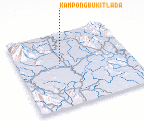 Places with similar names to Kampong Bukit Lada, Malaysia ::
// Kampong Bukit Lata (MY)
Disclaimer :: Information on this page comes without warranty of any kind |
||
|
Where is Kampong Bukit Lada? Elevation and coordinates ::
Latitude (lat): 3°36'0"N Longitude (lon): 102°23'0"E
Elevation (approx.): 64m (map arrows pan, magnifying glasses zoom) |
||
|
Visiting Kampong Bukit Lada? Hotel/Accommodation ::
Book a hotel in Kampong Bukit Lada Travel Guide ::
Buy a travel guide for Malaysia rental cars ::
car rental offers GPS waypoint ::
download a GPX waypoint (PoI) of Kampong Bukit Lada for your GPS receiver
|
||