|
search place name
|
||
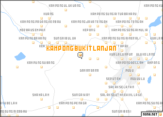
Kampong Bukit Lanjan (Malaysia)Kampong Bukit Lanjan is a town in Malaysia. An overview map of the region around Kampong Bukit Lanjan is displayed below.
regional and 3d topo map of Kampong Bukit Lanjan, Malaysia ::
nearby GPS traces from timatio ::
Kampong Bukit Lanjan airports ::
The nearest airport is KUL - Kuala Lumpur Intl, located 47.7 km south of Kampong Bukit Lanjan.
Other airports nearby include MKZ - Malacca (122.3 km south east), IPH - Ipoh Sultan Azlan Shah (165.5 km north), DUM - Dumai Pinang Kampai (173.4 km south), KUA - Kuantan (189.3 km east), Nearby towns ::
Kampong Tanah Jawa (1.9km east) //
Kampong Sungai Penchala (1.9km east) //
Kampong Pelimbaian (1.9km east) //
Kampong Segambut Dalam (3.7km east) //
Kampong Pasir Segambut (4.1km north east) //
Kepong Cubitt Forest Village (4.1km north west) //
Damansara (4.1km south east) //
Sungai Buluh (5.2km north west) //
Kampong Segambut (5.9km east) //
Kepong (5.9km north) //
Kampong Kepong (5.9km north) //
Kampong Bukit Mati (5.9km east) //
Kampung Baharu Sungai Buluh (6.7km north west) //
Kampong Bangkong (6.7km north east) //
Jinjang (6.7km north east) //
Kampong Jawa Tengah (7.6km north) //
Sentul (7.6km east) //
Kampong Paya Jaras Dalam (7.6km west) //
Pantai Valley (7.9km south east) //
Kampong Pinang Baik (8.3km north east) //
Batu (8.3km north east) //
Dusun Chinchin (8.3km north west) //
Kampong Paya Jaras (8.3km north west) //
Kampong Pak Karim (9.3km north east) //
Batu Caves (9.3km north east) //
Kampong Selayang (9.3km north east) //
Kampong Haji Abdullah Hukum (9.3km south east) //
Seputeh (9.3km south east) //
Kampong Pantai (9.3km south east) //
[all distances 'as the bird flies' and approximate] 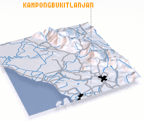 Places with similar names to Kampong Bukit Lanjan, Malaysia ::
// Kampong Bukit Lanjut (MY)
Disclaimer :: Information on this page comes without warranty of any kind |
||
|
Where is Kampong Bukit Lanjan? Elevation and coordinates ::
Latitude (lat): 3°10'0"N Longitude (lon): 101°37'0"E
Elevation (approx.): 57m (map arrows pan, magnifying glasses zoom) |
||
|
Visiting Kampong Bukit Lanjan? Hotel/Accommodation ::
Book a hotel in Kampong Bukit Lanjan Travel Guide ::
Buy a travel guide for Malaysia rental cars ::
car rental offers GPS waypoint ::
download a GPX waypoint (PoI) of Kampong Bukit Lanjan for your GPS receiver
|
||