|
search place name
|
||
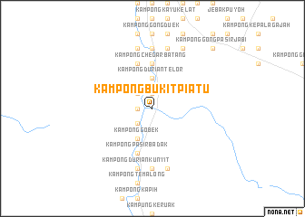
Kampong Bukit Piatu (Terengganu, Malaysia)Kampong Bukit Piatu is a town in the Terengganu region of Malaysia. An overview map of the region around Kampong Bukit Piatu is displayed below.
regional and 3d topo map of Kampong Bukit Piatu, Malaysia ::
Kampong Bukit Piatu airports ::
The nearest airport is KBR - Kota Bahru Sultan Ismail Petra, located 66.7 km north of Kampong Bukit Piatu.
Other airports nearby include TGG - Kuala Terengganu Sultan Mahmud (71.0 km east), NAW - Narathiwat (131.8 km north west), KTE - Kerteh (156.1 km south east), IPH - Ipoh Sultan Azlan Shah (193.4 km south west), Nearby towns ::
Kampong Mata Ayer (1.9km north) //
Kampong Tenang (1.8km west) //
Kampung Susun (2.6km north west) //
Kampong Gelugor (2.6km south west) //
Kampung Dengir (2.6km south west) //
Kampong Baharu (3.7km north) //
Kampung Pasir Akar (3.7km north) //
Kampong Durian Telor (3.7km north) //
Kampong Gobek (4.1km south west) //
Kampong Chegar Batang (5.6km north) //
Baroh Masin (5.6km north) //
Pasir Kanan (5.6km north) //
Kampong Pasir Badak (5.9km south) //
Kampong Padang Buioh (5.9km north) //
Kampong Batu (7.4km south) //
Kampong Padang Beras (7.4km south) //
Kampung Darau (7.4km north) //
Kampong Lipan Kejor (7.4km north) //
Kampong Kuala Peng (7.6km south) //
Kampong Panchor (7.6km south) //
Kampung La (7.6km south) //
Kampong Durian Kunyit (7.6km south) //
Kampong Awek (7.6km north) //
Kampong Lubok Pangkalan (7.6km north) //
Kampong Gong Che Abu (7.6km north) //
Kampong Oh (8.3km north east) //
Kampong Gong Dasar (10.5km north east) //
Kampong Gong Pasir Jabi (10.5km north east) //
[all distances 'as the bird flies' and approximate]  Places with similar names to Kampong Bukit Piatu, Malaysia ::
// Kampong Bukit Apit (MY)
// Kampong Bukit Piatu (MY)
Disclaimer :: Information on this page comes without warranty of any kind |
||
|
Where is Kampong Bukit Piatu? Elevation and coordinates ::
Latitude (lat): 5°36'0"N Longitude (lon): 102°30'0"E
Elevation (approx.): 28m (map arrows pan, magnifying glasses zoom) |
||
|
Visiting Kampong Bukit Piatu? Hotel/Accommodation ::
Book a hotel in Kampong Bukit Piatu Travel Guide ::
Buy a travel guide for Malaysia rental cars ::
car rental offers GPS waypoint ::
download a GPX waypoint (PoI) of Kampong Bukit Piatu for your GPS receiver
|
||