|
search place name
|
||
Kampong Bukit Seni (Kedah, Malaysia)Kampong Bukit Seni is a town in the Kedah region of Malaysia. An overview map of the region around Kampong Bukit Seni is displayed below.
regional and 3d topo map of Kampong Bukit Seni, Malaysia ::

Kampong Bukit Seni airports ::
The nearest airport is AOR - Alor Setar Sultan Abdul Halim, located 21.7 km north of Kampong Bukit Seni.
Other airports nearby include PEN - Penang Intl (80.1 km south), LGK - Pulau Langkawi Intl (87.8 km north west), HDY - Songkhla Hat Yai Intl (103.4 km north), PAN - Pattani (116.6 km north east), Nearby towns ::
Kampong Bukit Raya (1.9km north) //
Kampong Lang Merah (1.8km west) //
Pendang (1.8km east) //
Kampong Batu Menunggol (2.6km south east) //
Kampong Kubang Anak Gajah (2.6km south west) //
Kampong Alor Parit (2.6km south east) //
Kampong Limabelas Relong (2.6km north west) //
Kampong Tanjong Radin (2.6km north east) //
Kampong Manggol Petai (2.6km south east) //
Kampong Seberang Pendang (3.7km east) //
Kampong Rambai (3.7km north) //
Kampong Jelai (3.7km north) //
Kampong Alor Tok Ya (3.7km west) //
Kampong Batu Hampar (4.1km south east) //
Kampong Manggol Kambing (4.1km south east) //
Kampong Tanjong Radin (4.1km north east) //
Kampong Manggol Pauh (4.1km south east) //
Kampong Pendang (4.1km south east) //
Pekan Tanah Merah (4.1km north east) //
Kampong Tok Busan (4.1km south east) //
Alor Bungga Sena (4.1km north east) //
Kampong Paya Saga (4.1km south east) //
Kampung Kobah (4.1km south west) //
Kampong Alor Ali (4.1km north east) //
Kampong Pulau Wan Awang (4.1km south west) //
Kampong Pulai (4.1km north west) //
Kampong Alor Besar (4.1km south west) //
Kampong Alor Pering (5.2km north east) //
Kampong Pulau Machang (5.2km south east) //
[all distances 'as the bird flies' and approximate] 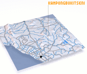 Places with similar names to Kampong Bukit Seni, Malaysia :: Disclaimer :: Information on this page comes without warranty of any kind |
||
|
Where is Kampong Bukit Seni? Elevation and coordinates ::
Latitude (lat): 6°0'0"N Longitude (lon): 100°27'0"E
Elevation (approx.): 5m (map arrows pan, magnifying glasses zoom) |
||
|
Visiting Kampong Bukit Seni? Hotel/Accommodation ::
Book a hotel in Kampong Bukit Seni Travel Guide ::
Buy a travel guide for Malaysia rental cars ::
car rental offers GPS waypoint ::
download a GPX waypoint (PoI) of Kampong Bukit Seni for your GPS receiver
|
||