|
search place name
|
||
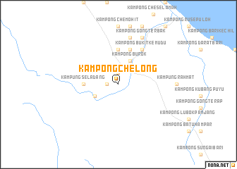
Kampong Che Long (Terengganu, Malaysia)Kampong Che Long is a town in the Terengganu region of Malaysia. An overview map of the region around Kampong Che Long is displayed below.
regional and 3d topo map of Kampong Che Long, Malaysia ::
Kampong Che Long airports ::
The nearest airport is TGG - Kuala Terengganu Sultan Mahmud, located 43.0 km east of Kampong Che Long.
Other airports nearby include KBR - Kota Bahru Sultan Ismail Petra (88.4 km north west), KTE - Kerteh (131.3 km south east), NAW - Narathiwat (157.3 km north west), KUA - Kuantan (197.9 km south), Nearby towns ::
Kampung Besut (1.8km west) //
Kampong Bukit Pepapari (1.9km north) //
Kampong Alor Bongor (4.1km south west) //
Kampung Padang (4.1km south west) //
Kampong Burok (4.1km north east) //
Kampung Buluh (4.1km north east) //
Kampung Seladang (5.5km west) //
Kampong Apek (5.6km north) //
Kampung Tasek (5.9km north) //
Kampong Bukit Kemudu (6.7km north east) //
Rotan Sega (7.6km north) //
Baroh Bongor (7.6km north) //
Kampong Banggol (8.3km north east) //
Kampong Gong Terbak (8.3km north east) //
[all distances 'as the bird flies' and approximate] 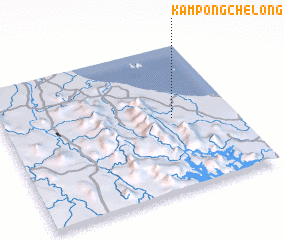 Places with similar names to Kampong Che Long, Malaysia ::
// Kampong Sialang (MY)
// Kampong Chelong (MY)
Disclaimer :: Information on this page comes without warranty of any kind |
||
|
Where is Kampong Che Long? Elevation and coordinates ::
Latitude (lat): 5°30'0"N Longitude (lon): 102°44'0"E
Elevation (approx.): 16m (map arrows pan, magnifying glasses zoom) |
||
|
Visiting Kampong Che Long? Hotel/Accommodation ::
Book a hotel in Kampong Che Long Travel Guide ::
Buy a travel guide for Malaysia rental cars ::
car rental offers GPS waypoint ::
download a GPX waypoint (PoI) of Kampong Che Long for your GPS receiver
|
||