|
search place name
|
||
Kampong Chenderong Batu (Kelantan, Malaysia)Kampong Chenderong Batu is a town in the Kelantan region of Malaysia. An overview map of the region around Kampong Chenderong Batu is displayed below.
regional and 3d topo map of Kampong Chenderong Batu, Malaysia ::

Kampong Chenderong Batu airports ::
The nearest airport is KBR - Kota Bahru Sultan Ismail Petra, located 12.7 km east of Kampong Chenderong Batu.
Other airports nearby include NAW - Narathiwat (64.8 km north west), TGG - Kuala Terengganu Sultan Mahmud (131.4 km south east), PAN - Pattani (134.8 km north west), AOR - Alor Setar Sultan Abdul Halim (197.7 km west), Nearby towns ::
Kampong Kubang Batang (0.0km north) //
Kampong Delima (1.9km south) //
Kampong Belukar (1.9km south) //
Kampong Lati (1.9km south) //
Kampong Selak (1.8km west) //
Kampong Banggol Petani (1.8km west) //
Kampong Seberang Baroh (1.8km west) //
Kampong Alor Tok Menbra (1.9km north) //
Kampong Bechah Resak (1.9km north) //
Kampong Bechah Gerda (1.9km north) //
Kampong Alor Tal (1.9km north) //
Kampong Periok (1.9km north) //
Kampong Bunut Sarang Burong (1.8km east) //
Kampong Kebakat (1.8km east) //
Kampong Jal Kechil (2.6km south west) //
Kampong Teliar (2.6km south west) //
Kampong Lambor (2.6km south west) //
Wakaf Baharu (2.6km south east) //
Kampong Mulong (2.6km south east) //
Chabang Empat (2.6km north west) //
Kampong Jal Besar (3.7km west) //
Kampong Padang Mandor (3.7km west) //
Kampong Ana (3.7km west) //
Kampong Kulim (3.7km south) //
Kampong Teliar (3.7km south) //
Chabang Tiga (3.7km north) //
Kampong Ayer Dingin (3.7km north) //
Kampong Bendang Kering (3.7km north) //
Kampong Samat Jal (3.7km east) //
[all distances 'as the bird flies' and approximate] 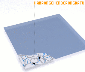 Places with similar names to Kampong Chenderong Batu, Malaysia ::
// Kampong Chenderong Balai (MY)
// Kampong Chenderong Leban (MY)
Disclaimer :: Information on this page comes without warranty of any kind |
||
|
Where is Kampong Chenderong Batu? Elevation and coordinates ::
Latitude (lat): 6°8'0"N Longitude (lon): 102°11'0"E
Elevation (approx.): 12m (map arrows pan, magnifying glasses zoom) |
||
|
Visiting Kampong Chenderong Batu? Hotel/Accommodation ::
Book a hotel in Kampong Chenderong Batu Travel Guide ::
Buy a travel guide for Malaysia rental cars ::
car rental offers GPS waypoint ::
download a GPX waypoint (PoI) of Kampong Chenderong Batu for your GPS receiver
|
||