|
search place name
|
||
Kampong Chengal (Kelantan, Malaysia)Kampong Chengal is a town in the Kelantan region of Malaysia. An overview map of the region around Kampong Chengal is displayed below.
regional and 3d topo map of Kampong Chengal, Malaysia ::

Kampong Chengal airports ::
The nearest airport is KBR - Kota Bahru Sultan Ismail Petra, located 14.9 km north west of Kampong Chengal.
Other airports nearby include NAW - Narathiwat (86.8 km north west), TGG - Kuala Terengganu Sultan Mahmud (109.9 km south east), PAN - Pattani (157.6 km north west), KTE - Kerteh (204.9 km south east), Nearby towns ::
Kampong Pengkalan Chengal (0.0km north) //
Kampong Tenkorak (0.0km north) //
Kampung Perupuk (1.9km north) //
Kampong Sungai (1.9km north) //
Kampong Panjang (1.9km north) //
Kampong Bachok (1.9km north) //
Kampong Surau Pepari (1.9km north) //
Kampong Tanjong Pauh (1.8km west) //
Kampong Beris Kubor Besar (1.8km west) //
Kampong Pak Pura (1.8km west) //
Kampong Keluat (1.9km south) //
Kampong Pantai Damat (1.8km east) //
Bachok (1.8km east) //
Kampong Tok Belian (2.6km north west) //
Kampong Gong Irat (2.6km north west) //
Kampong Kubang Kawah (2.6km north east) //
Kampong Padang Bual (2.6km south west) //
Kampong Beklam (2.6km south west) //
Kampong Tanjong Hilir (2.6km south west) //
Kampong Kemudi (2.6km south east) //
Kampong Surau (2.6km south east) //
Kampong Rengas (2.6km south east) //
Kampung Balai (3.7km north) //
Kampong Tok Chong (3.7km north) //
Kampong Kubang Golok (3.7km north) //
Kampong Jenera (3.7km west) //
Kampong Tanjong Jering (3.7km west) //
Kampong Tasek (3.7km west) //
Kampong Penghulu Kob (3.7km west) //
[all distances 'as the bird flies' and approximate] 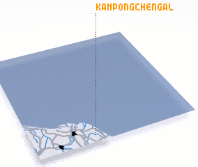 Places with similar names to Kampong Chengal, Malaysia :: Disclaimer :: Information on this page comes without warranty of any kind |
||
|
Where is Kampong Chengal? Elevation and coordinates ::
Latitude (lat): 6°4'0"N Longitude (lon): 102°23'0"E
Elevation (approx.): 9m (map arrows pan, magnifying glasses zoom) |
||
|
Visiting Kampong Chengal? Hotel/Accommodation ::
Book a hotel in Kampong Chengal Travel Guide ::
Buy a travel guide for Malaysia rental cars ::
car rental offers GPS waypoint ::
download a GPX waypoint (PoI) of Kampong Chengal for your GPS receiver
|
||