|
search place name
|
||
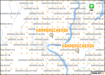
Kampong Chenok (Kelantan, Malaysia)Kampong Chenok is a town in the Kelantan region of Malaysia. An overview map of the region around Kampong Chenok is displayed below.
regional and 3d topo map of Kampong Chenok, Malaysia ::
Kampong Chenok airports ::
The nearest airport is KBR - Kota Bahru Sultan Ismail Petra, located 17.8 km north east of Kampong Chenok.
Other airports nearby include NAW - Narathiwat (68.6 km north west), TGG - Kuala Terengganu Sultan Mahmud (128.4 km south east), PAN - Pattani (137.4 km north west), AOR - Alor Setar Sultan Abdul Halim (196.2 km west), Nearby towns ::
Kampong Kubang Nyamok (0.0km north) //
Kampong Bechah Menerong (1.9km north) //
Bunut Susu (1.9km north) //
Kampong Manok (1.9km north) //
Kampong Serdang (1.8km east) //
Kampong Kubang Bunut (1.8km east) //
Kampong Kubang Bemban (1.8km west) //
Kampong Machang (1.8km west) //
Kampong Kasar (1.9km south) //
Kampong Landa (1.9km south) //
Kampong Kubang Badak (1.9km south) //
Kampong Bechah Durian (2.6km north east) //
Kampong Jejulok (2.6km north east) //
Kampong Kuchang (2.6km north east) //
Kampong Limbat (2.6km north west) //
Kampong Hutan Pasir (2.6km south east) //
Kampong Bechah Semak (3.7km north) //
Kampong Gaung (3.7km east) //
Kampong Resak (3.7km east) //
Kampong Bechah (3.7km east) //
Kampong Belukar (3.7km west) //
Kampong Mat Lajin (3.7km west) //
Kampong Betong (3.7km south) //
Kampong Padang Chenok (3.7km south) //
Kampong Teliar (4.1km north east) //
Kampong Kulim (4.1km north east) //
Kampong Hutan Chengal (4.1km north east) //
Kampong Kubang Mas (4.1km north east) //
Kampong Kubang Palas (4.1km north east) //
[all distances 'as the bird flies' and approximate]  Places with similar names to Kampong Chenok, Malaysia ::
// Kampong Siong (MY)
// Kampong Tiong (MY)
// Kampong Tiong (MY)
// Kampong Tiong (MY)
// Kampong Tiong (MY)
// Kampong Changgai (MY)
// Kampong Chenaga (MY)
// Kampong Chenak (MY)
// Kampong Cheng (MY)
// Kampong Chengai (MY)
Disclaimer :: Information on this page comes without warranty of any kind |
||
|
Where is Kampong Chenok? Elevation and coordinates ::
Latitude (lat): 6°4'0"N Longitude (lon): 102°10'0"E
Elevation (approx.): 10m (map arrows pan, magnifying glasses zoom) |
||
|
Visiting Kampong Chenok? Hotel/Accommodation ::
Book a hotel in Kampong Chenok Travel Guide ::
Buy a travel guide for Malaysia rental cars ::
car rental offers GPS waypoint ::
download a GPX waypoint (PoI) of Kampong Chenok for your GPS receiver
|
||