|
search place name
|
||
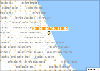
Kampong Darat Aur (Kelantan, Malaysia)Kampong Darat Aur is a town in the Kelantan region of Malaysia. An overview map of the region around Kampong Darat Aur is displayed below.
regional and 3d topo map of Kampong Darat Aur, Malaysia ::
Kampong Darat Aur airports ::
The nearest airport is KBR - Kota Bahru Sultan Ismail Petra, located 25.6 km north west of Kampong Darat Aur.
Other airports nearby include NAW - Narathiwat (96.7 km north west), TGG - Kuala Terengganu Sultan Mahmud (99.6 km south east), PAN - Pattani (167.1 km north west), KTE - Kerteh (194.2 km south east), Nearby towns ::
Kampong Limau Nipis (0.0km north) //
Kampong Aur (0.0km north) //
Kampung Telung (1.9km south) //
Kampong Cham Tangga (1.8km west) //
Kampong Sungai Dua (1.9km north) //
Kampung Ger (1.9km north) //
Kampong Pak Elong (2.6km south west) //
Kampong Rekang (2.6km north west) //
Kampong Kuala Rekang (2.6km north west) //
Kampong Kolam Lubok Serdang (3.7km south) //
Kampong Ayer Terjun Pinang (3.7km south) //
Kampong Alor Pulai (4.1km south west) //
Kampong Niman (4.1km north west) //
Kampong Gelong Gajah (4.1km north west) //
Kampong Kandis (4.1km south east) //
Kampong Repek (4.1km north west) //
Chabang Tiga Melawi (4.1km north west) //
Kampung Kuala Melawi (4.1km north west) //
Kampong Kuau (5.2km north west) //
Kampong Rekang (5.2km north west) //
Tangok (5.2km north west) //
Kampong Toker (5.5km west) //
Kampong Mujor (5.5km west) //
Kampong Alor Ganu (5.5km west) //
Kampong Gong Chengal (5.8km west) //
Kampong Telaga Ara (5.8km west) //
Kampong Changgong (5.9km north) //
Kampong Chat (5.9km north) //
Kampong Melawi (5.9km north) //
[all distances 'as the bird flies' and approximate] 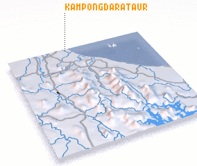 Places with similar names to Kampong Darat Aur, Malaysia :: Disclaimer :: Information on this page comes without warranty of any kind |
||
|
Where is Kampong Darat Aur? Elevation and coordinates ::
Latitude (lat): 5°59'0"N Longitude (lon): 102°26'0"E
Elevation (approx.): 11m (map arrows pan, magnifying glasses zoom) |
||
|
Visiting Kampong Darat Aur? Hotel/Accommodation ::
Book a hotel in Kampong Darat Aur Travel Guide ::
Buy a travel guide for Malaysia rental cars ::
car rental offers GPS waypoint ::
download a GPX waypoint (PoI) of Kampong Darat Aur for your GPS receiver
|
||