|
search place name
|
||
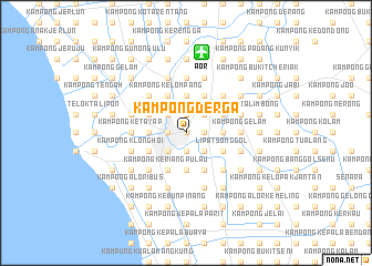
Kampong Derga (Kedah, Malaysia)Kampong Derga is a town in the Kedah region of Malaysia. An overview map of the region around Kampong Derga is displayed below.
regional and 3d topo map of Kampong Derga, Malaysia ::
Kampong Derga airports ::
The nearest airport is AOR - Alor Setar Sultan Abdul Halim, located 8.2 km north of Kampong Derga.
Other airports nearby include LGK - Pulau Langkawi Intl (76.2 km west), HDY - Songkhla Hat Yai Intl (90.3 km north), PEN - Penang Intl (91.4 km south), PAN - Pattani (112.8 km north east), Nearby towns ::
Kampong Chepoh (0.0km north) //
Kampong Alor Melong (0.0km north) //
Kampong Komol (1.9km north) //
Kampong Bakar Bata (1.9km north) //
Kampong Huma (1.9km north) //
Alor Setar (1.8km west) //
Kampong Pengkalan Putat (1.9km south) //
Kampong Ganding (1.9km south) //
Kampong Balek Hutan (1.8km east) //
Kampong Sakan (1.8km east) //
Kampong Lubok Peringgi (2.6km north west) //
Kampong Alor Malai (2.6km north west) //
Kampong Alor Segamat (2.6km north east) //
Kampong Telok (2.6km south west) //
Kampong Pegawai (2.6km south west) //
Kampong Tanjong Bendahara (2.6km south west) //
Kampong Lubok Pupok (2.6km south east) //
Kampong Gerigis (2.6km south east) //
Kampong Hilir (3.7km north) //
Kampong Hutam Keriang (3.7km north) //
Kampong Seberang Perak (3.7km west) //
Kampong Pagar Ayer (3.7km east) //
Kampong Pelilit (3.7km east) //
Kampong Alor Semala (3.7km east) //
Perendam Raja (3.7km south) //
Kampong Kelompang (4.1km north west) //
Kampong Seberang Pumpong (4.1km north west) //
Alur Merah (4.1km north west) //
Kampong Pumpong (4.1km north west) //
[all distances 'as the bird flies' and approximate] 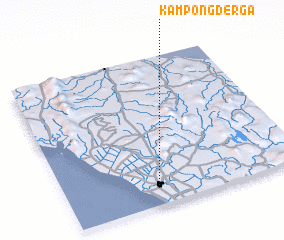 Places with similar names to Kampong Derga, Malaysia ::
Disclaimer :: Information on this page comes without warranty of any kind |
||
|
Where is Kampong Derga? Elevation and coordinates ::
Latitude (lat): 6°7'0"N Longitude (lon): 100°23'0"E
Elevation (approx.): 5m (map arrows pan, magnifying glasses zoom) |
||
|
Visiting Kampong Derga? Hotel/Accommodation ::
Book a hotel in Kampong Derga Travel Guide ::
Buy a travel guide for Malaysia rental cars ::
car rental offers GPS waypoint ::
download a GPX waypoint (PoI) of Kampong Derga for your GPS receiver
|
||