|
search place name
|
||
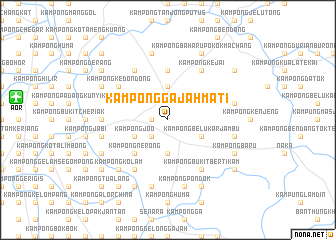
Kampong Gajah Mati (Kedah, Malaysia)Kampong Gajah Mati is a town in the Kedah region of Malaysia. An overview map of the region around Kampong Gajah Mati is displayed below.
regional and 3d topo map of Kampong Gajah Mati, Malaysia ::
Kampong Gajah Mati airports ::
The nearest airport is AOR - Alor Setar Sultan Abdul Halim, located 17.0 km west of Kampong Gajah Mati.
Other airports nearby include HDY - Songkhla Hat Yai Intl (86.5 km north), LGK - Pulau Langkawi Intl (92.7 km west), PAN - Pattani (95.6 km north east), PEN - Penang Intl (100.8 km south), Nearby towns ::
Pokok Sena (1.8km west) //
Kampong Pelandok (2.6km south west) //
Kampong Larit (3.7km north) //
Kampong Kubang Paya (3.7km south) //
Kampong Joo (4.1km south west) //
Kampong Belukar Jambu (4.1km south east) //
Kampong Nerong (5.2km south west) //
Kampong Bukit Tembaga (5.6km north) //
Kampong Panchor (6.7km north west) //
Kampong Kedondong (6.7km north west) //
Kampong Kuan Buang (6.7km south west) //
Kampong Kejai (6.7km north east) //
Kampong Bukit Bertikam (6.7km south east) //
Kampong Lanjut (7.4km west) //
Kampong Paya Kelubi (7.6km north) //
Kampong Pong Manis (7.6km east) //
Kampong Telaga Dalam (7.6km west) //
Kampong Lanjut Malau (7.6km west) //
Kampung Bukit (7.6km east) //
Kampong Paya Besar (7.6km south) //
Kampong Pondok (7.6km south) //
Kampong Kolam (7.8km south west) //
Kampong Baharu Pokok Machang (8.3km north east) //
Kampong Pulau Keramat (8.3km south west) //
Kampong Bukit Hijau (8.2km north west) //
Kampong Perupok (8.3km south east) //
Kampong Baru (8.3km south east) //
Kampong Keriang Manora (8.3km south west) //
Kampong Matang Limau (9.2km south west) //
[all distances 'as the bird flies' and approximate] 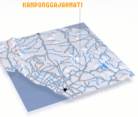 Places with similar names to Kampong Gajah Mati, Malaysia ::
// Kampung Gajah Mati (MY)
// Kampong Gajah Mati (MY)
// Kampong Gajah Mati (MY)
// Kampong Gajah Mati (MY)
// Kampong Gajah Mati (MY)
// Kampong Gajah Mati (MY)
// Kampong Gajah Mati (MY)
// Kampong Gajah Mati (MY)
Disclaimer :: Information on this page comes without warranty of any kind |
||
|
Where is Kampong Gajah Mati? Elevation and coordinates ::
Latitude (lat): 6°10'0"N Longitude (lon): 100°33'0"E
Elevation (approx.): 22m (map arrows pan, magnifying glasses zoom) |
||
|
Visiting Kampong Gajah Mati? Hotel/Accommodation ::
Book a hotel in Kampong Gajah Mati Travel Guide ::
Buy a travel guide for Malaysia rental cars ::
car rental offers GPS waypoint ::
download a GPX waypoint (PoI) of Kampong Gajah Mati for your GPS receiver
|
||