|
search place name
|
||
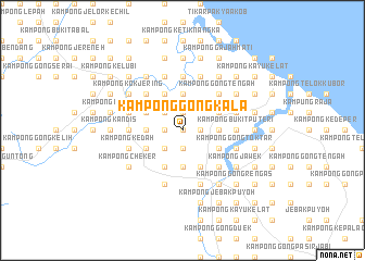
Kampong Gong Kala (Kelantan, Malaysia)Kampong Gong Kala is a town in the Kelantan region of Malaysia. An overview map of the region around Kampong Gong Kala is displayed below.
regional and 3d topo map of Kampong Gong Kala, Malaysia ::
Kampong Gong Kala airports ::
The nearest airport is KBR - Kota Bahru Sultan Ismail Petra, located 46.6 km north west of Kampong Gong Kala.
Other airports nearby include TGG - Kuala Terengganu Sultan Mahmud (83.3 km south east), NAW - Narathiwat (114.2 km north west), KTE - Kerteh (174.1 km south east), PAN - Pattani (182.7 km north west), Nearby towns ::
Kampong Sungai Tasek (0.0km north) //
Kampong Dalam Huma (0.0km north) //
Kampong Gong Lapang (1.8km east) //
Kampong Gong Darat Lapang (1.8km east) //
Kampong Pak Abu (1.8km east) //
Alor Nibong (1.9km south) //
Kampong Gong Pachat (1.9km north) //
Kampong Gong Chokoh (1.9km north) //
Kampong Gong Guchil (1.9km north) //
Kampong Gong Keding (1.9km north) //
Kampong Gong Tinggi (1.9km north) //
Kampong Gong Nangka (1.8km west) //
Kampong Gong Bayu (2.6km south west) //
Kampong Alor Kelubi (2.6km south west) //
Kampong Bukit Awang (2.6km south west) //
Kampong Gong Ambong (2.6km south west) //
Kampong Gong Kemuning (2.6km south west) //
Kampong Gong Pasir (2.6km north west) //
Kampong Gong Sepuleh (2.6km north west) //
Kampong Gong Datok (2.6km north west) //
Kampong Beris Pak Abu (3.7km east) //
Kampong Ayer Terjun (3.7km south) //
Kampong Gong Depu (3.7km north) //
Kampung Gong Tapang (3.7km north) //
Kampong Gong Kemudu (3.7km north) //
Kampong Kemudu Bongkok (3.7km west) //
Kampong Sungai Gali (3.7km west) //
Kampong Alor Pasir (3.7km west) //
Kampong Derdap (3.7km west) //
[all distances 'as the bird flies' and approximate] 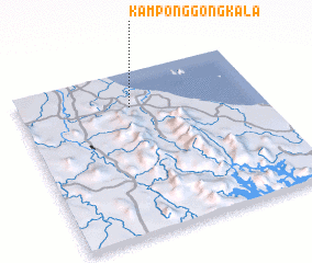 Places with similar names to Kampong Gong Kala, Malaysia ::
// Kampong Gong Kelih (MY)
Disclaimer :: Information on this page comes without warranty of any kind |
||
|
Where is Kampong Gong Kala? Elevation and coordinates ::
Latitude (lat): 5°47'0"N Longitude (lon): 102°28'0"E
Elevation (approx.): 11m (map arrows pan, magnifying glasses zoom) |
||
|
Visiting Kampong Gong Kala? Hotel/Accommodation ::
Book a hotel in Kampong Gong Kala Travel Guide ::
Buy a travel guide for Malaysia rental cars ::
car rental offers GPS waypoint ::
download a GPX waypoint (PoI) of Kampong Gong Kala for your GPS receiver
|
||