|
search place name
|
||
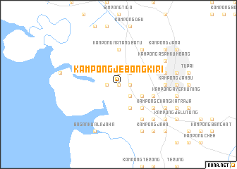
Kampong Jebong Kiri (Perak, Malaysia)Kampong Jebong Kiri is a town in the Perak region of Malaysia. An overview map of the region around Kampong Jebong Kiri is displayed below.
regional and 3d topo map of Kampong Jebong Kiri, Malaysia ::
Kampong Jebong Kiri airports ::
The nearest airport is IPH - Ipoh Sultan Azlan Shah, located 57.2 km south east of Kampong Jebong Kiri.
Other airports nearby include PEN - Penang Intl (65.9 km north west), AOR - Alor Setar Sultan Abdul Halim (152.6 km north), LGK - Pulau Langkawi Intl (194.4 km north west), NAW - Narathiwat (222.4 km north east), Nearby towns ::
Kampong Kereta Api (NaNkm north) //
Kampong Tebok (NaNkm north) //
Kampong Jebong Kanan (1.8km east) //
Kampong Tebing Tinggi (1.8km east) //
Kampong Batu Dua (1.9km north) //
Kampung Sepetang (1.8km west) //
Kampong Sungai Rantaka (2.6km south east) //
Kampong Matang Batu (2.6km north east) //
Kampung Pekan Matang (4.1km south east) //
Matang (4.1km south east) //
Kampong Rimba Piatu (4.1km south east) //
Kampong Sungai Lang (5.2km south east) //
Kampong Matang Batu (5.6km north) //
Simpang (5.8km east) //
Kampong Simpang Haji Adam (5.8km east) //
Kampong Matang Gelugor (6.7km south east) //
Kampong Matang Jambu (6.7km south east) //
Kampong Ayer Puteh (6.7km north east) //
Kampong Larut Tin (7.4km east) //
Au Long (7.6km east) //
Kampong Boyan (7.6km east) //
Kampong Perak (7.8km south east) //
Kampong Matang Pasir (8.3km south east) //
Bagan Kuala Jaha (8.3km south west) //
Kampong Changkat Raja (8.3km south east) //
Kampong Padang Besar (8.3km south east) //
Kampong Tekka (8.3km north east) //
Kampong Asam Kumbang (8.3km north east) //
Kampong Jaha (9.3km south east) //
[all distances 'as the bird flies' and approximate] 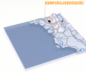 Places with similar names to Kampong Jebong Kiri, Malaysia :: Disclaimer :: Information on this page comes without warranty of any kind |
||
|
Where is Kampong Jebong Kiri? Elevation and coordinates ::
Latitude (lat): 4°50'0"N Longitude (lon): 100°39'0"E
Elevation (approx.): 3m (map arrows pan, magnifying glasses zoom) |
||
|
Visiting Kampong Jebong Kiri? Hotel/Accommodation ::
Book a hotel in Kampong Jebong Kiri Travel Guide ::
Buy a travel guide for Malaysia rental cars ::
car rental offers GPS waypoint ::
download a GPX waypoint (PoI) of Kampong Jebong Kiri for your GPS receiver
|
||