|
search place name
|
||
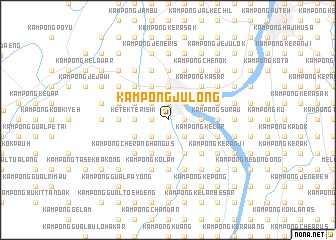
Kampong Julong (Kelantan, Malaysia)Kampong Julong is a town in the Kelantan region of Malaysia. An overview map of the region around Kampong Julong is displayed below.
regional and 3d topo map of Kampong Julong, Malaysia ::
Kampong Julong airports ::
The nearest airport is KBR - Kota Bahru Sultan Ismail Petra, located 24.3 km north east of Kampong Julong.
Other airports nearby include NAW - Narathiwat (70.4 km north west), TGG - Kuala Terengganu Sultan Mahmud (128.3 km south east), PAN - Pattani (137.8 km north west), AOR - Alor Setar Sultan Abdul Halim (193.0 km west), Nearby towns ::
Pasir Mas (1.9km north) //
Kampong Endong (1.9km north) //
Kampong Tanjong Rendang (1.9km north) //
Kampong Apam (1.8km west) //
Kampong Berangan (1.8km west) //
Kampong Kepas (1.8km west) //
Kampong Lati (1.8km west) //
Kampong Tukang Draman (1.9km south) //
Kampong Telago Bata (1.9km south) //
Kampong Lubok Tapah (1.8km east) //
Kampong Kabu (1.8km east) //
Kampong Kiat (2.6km north west) //
Kampong Gaung (2.6km north west) //
Kampong Pak Limah (2.6km north east) //
Kampong Pasir Mas (2.6km north east) //
Kampong Biak (2.6km south west) //
Kampong Paloh (2.6km south west) //
Kampong Banggol Jering (2.6km south west) //
Kampong Chicha Tinggi (2.6km south east) //
Kampong Bemban (2.6km south east) //
Kampong Pauh (3.7km north) //
Kampong Taman (3.7km west) //
Ketek Terisik (3.7km west) //
Kampong Pengkalan Rambutan (3.7km east) //
Kampong Gabus (3.7km south) //
Kampong Teraji (3.7km south) //
Kampong Lubok Chekok (4.1km north west) //
Kampong Banggol Chicha (4.1km north west) //
Kampong Repek (4.1km north west) //
[all distances 'as the bird flies' and approximate]  Places with similar names to Kampong Julong, Malaysia ::
Disclaimer :: Information on this page comes without warranty of any kind |
||
|
Where is Kampong Julong? Elevation and coordinates ::
Latitude (lat): 6°1'0"N Longitude (lon): 102°8'0"E
Elevation (approx.): 11m (map arrows pan, magnifying glasses zoom) |
||
|
Visiting Kampong Julong? Hotel/Accommodation ::
Book a hotel in Kampong Julong Travel Guide ::
Buy a travel guide for Malaysia rental cars ::
car rental offers GPS waypoint ::
download a GPX waypoint (PoI) of Kampong Julong for your GPS receiver
|
||