|
search place name
|
||
Kampong Kationg (Sabah, Malaysia)Kampong Kationg is a town in the Sabah region of Malaysia. An overview map of the region around Kampong Kationg is displayed below.
regional and 3d topo map of Kampong Kationg, Malaysia ::

Kampong Kationg airports ::
The nearest airport is BKI - Kota Kinabalu Intl, located 51.6 km west of Kampong Kationg.
Other airports nearby include LBU - Labuan (157.6 km south west), BWN - Brunei Intl (208.2 km south west), LMN - Limbang (209.3 km south west), LDU - Lahad Datu (224.5 km south east), Nearby towns ::
Kampong Terlabaw (0.0km north) //
Kampong Tinatasan (1.8km west) //
Kampong Pulutan (2.6km north east) //
Kampong Kubong (2.6km south east) //
Kampong Sandatan (2.6km south west) //
Kampong Tegudon (3.7km east) //
Kampong Toboh (3.7km west) //
Kampong Kitangong (4.1km south east) //
Bundu Tuhan (4.1km north east) //
Kampong Pahu (4.1km north east) //
Kampong Runguh (4.1km south east) //
Kampong Dudan (4.1km south west) //
Kampong Tiong Karanahan (4.1km north west) //
Kampong Kinasaraban (5.2km north east) //
Kampong Lagup (5.2km north east) //
Kampong Talantong (5.2km south east) //
Kampong Tiong (5.2km south east) //
Kampong Tiong Ratau (5.2km north west) //
Kampong Tiong Simpodon (5.2km north west) //
Kampong Bundu (5.5km west) //
Kampong Mehemboyan (5.5km east) //
Kampong Kirongkim (5.9km south) //
Kampong Karanahan (5.9km south) //
Kampong Taruvad (5.9km south) //
Kampong Tiong Tambinong (5.8km west) //
Kampong Wang (5.8km east) //
Kampong Samalang (6.7km south east) //
Kampong Kiwaluhu (6.7km south east) //
Kampong Kundassan (6.7km north east) //
[all distances 'as the bird flies' and approximate] 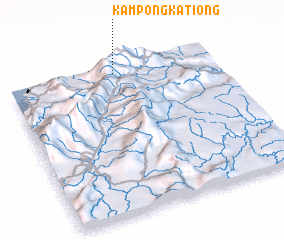 Places with similar names to Kampong Kationg, Malaysia ::
// Kampong Kuchang (MY)
// Kampong Kachong (MY)
Disclaimer :: Information on this page comes without warranty of any kind |
||
|
Where is Kampong Kationg? Elevation and coordinates ::
Latitude (lat): 5°57'0"N Longitude (lon): 116°31'0"E
Elevation (approx.): 1132m (map arrows pan, magnifying glasses zoom) |
||
|
Visiting Kampong Kationg? Hotel/Accommodation ::
Book a hotel in Kampong Kationg Travel Guide ::
Buy a travel guide for Malaysia rental cars ::
car rental offers GPS waypoint ::
download a GPX waypoint (PoI) of Kampong Kationg for your GPS receiver
|
||