|
search place name
|
||
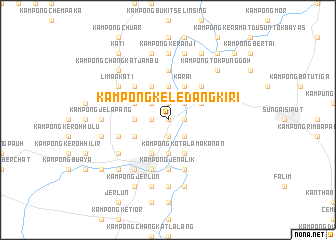
Kampong Keledang Kiri (Perak, Malaysia)Kampong Keledang Kiri is a town in the Perak region of Malaysia. An overview map of the region around Kampong Keledang Kiri is displayed below.
regional and 3d topo map of Kampong Keledang Kiri, Malaysia ::
Kampong Keledang Kiri airports ::
The nearest airport is IPH - Ipoh Sultan Azlan Shah, located 31.7 km south east of Kampong Keledang Kiri.
Other airports nearby include PEN - Penang Intl (91.6 km north west), AOR - Alor Setar Sultan Abdul Halim (163.7 km north), NAW - Narathiwat (207.9 km north east), KBR - Kota Bahru Sultan Ismail Petra (210.8 km north east), Nearby towns ::
Kampong Beluru (0.0km north) //
Kampong Jamuan (0.0km north) //
Kampong Punti (0.0km north) //
Kampong Kubang Halban (1.9km north) //
Kampong Rimba (1.9km north) //
Kampong Keledang (1.9km south) //
Kampong Mesjid (1.9km south) //
Kampong Geliong (1.8km west) //
Kampong Batang Kulim (1.8km east) //
Kampong Ribu (2.6km north west) //
Kampong Lembah Jamuan (2.6km north east) //
Kampong Karai Kiri (2.6km north east) //
Kampong Enggor (2.6km north east) //
Enggur (2.6km north east) //
Kampong Pasir Batang Kulim (2.6km south east) //
Kampong Padang Petai (2.6km south east) //
Kampong Lubok Chaping (3.7km north) //
Kampong Suak Parang (3.7km north) //
Kampong Kekabu Hutan (3.7km west) //
Kampong Rasau (3.7km west) //
Kampong Tanah Merah (3.7km west) //
Kampong Jias (3.7km south) //
Kampong Kandang (3.7km south) //
Kampong Penaga (3.7km south) //
Kampong Pasong (3.7km south) //
Kampong Parit (3.7km south) //
Kampong Sayong (3.7km south) //
Kampong Setia (4.1km north east) //
Kampong Ulu Langkor (4.1km north west) //
[all distances 'as the bird flies' and approximate] 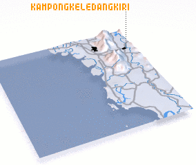 Places with similar names to Kampong Keledang Kiri, Malaysia :: Disclaimer :: Information on this page comes without warranty of any kind |
||
|
Where is Kampong Keledang Kiri? Elevation and coordinates ::
Latitude (lat): 4°49'0"N Longitude (lon): 100°57'0"E
Elevation (approx.): 48m (map arrows pan, magnifying glasses zoom) |
||
|
Visiting Kampong Keledang Kiri? Hotel/Accommodation ::
Book a hotel in Kampong Keledang Kiri Travel Guide ::
Buy a travel guide for Malaysia rental cars ::
car rental offers GPS waypoint ::
download a GPX waypoint (PoI) of Kampong Keledang Kiri for your GPS receiver
|
||