|
search place name
|
||
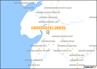
Kampong Kelubong (Perak, Malaysia)Kampong Kelubong is a town in the Perak region of Malaysia. An overview map of the region around Kampong Kelubong is displayed below.
regional and 3d topo map of Kampong Kelubong, Malaysia ::
Kampong Kelubong airports ::
The nearest airport is IPH - Ipoh Sultan Azlan Shah, located 45.4 km east of Kampong Kelubong.
Other airports nearby include PEN - Penang Intl (92.5 km north west), AOR - Alor Setar Sultan Abdul Halim (182.2 km north), LGK - Pulau Langkawi Intl (221.8 km north west), KUL - Kuala Lumpur Intl (231.4 km south east), Nearby towns ::
Kampung Sungai Tinggi (1.9km north) //
Kampong Port Weld (2.6km south west) //
Kampong Sungai Hut (2.6km south west) //
Kampong Sungai Kerang (3.7km north) //
Kampong Sungai Nyior (3.7km north) //
Kampong Kedah (3.7km south) //
Kampong Che Rahmat (4.1km south west) //
Kampong Hampar Dalam (4.1km south east) //
Kampong Batu Hampar (5.2km south east) //
Kampong Padang Serai (5.6km south) //
Kampong Jarum Mas (5.6km north) //
Durian Sebatang (5.8km east) //
Kampong Matang Acheh (5.9km south) //
Kampong Sungai Rotan (5.8km east) //
Kampong Panchor (6.7km south west) //
Bagan Panchor Luar (6.7km south west) //
Bagan Panchor Dalam (6.7km south west) //
Kampung Padang Gajah (6.7km north east) //
Kampung Baharu Padang Gajah (6.7km north east) //
Kampong Pengkalan Damar (6.7km south east) //
Kampong Sungai Tanah Liat (7.4km north) //
Kampong Sungai Tontong (8.3km south west) //
Kampong Sungai Tuntong (8.3km south west) //
Lombong Ha Chu (8.3km south east) //
Kampong Che Puteh (9.3km south east) //
Kampong Ulu Beruas (9.2km south east) //
[all distances 'as the bird flies' and approximate] 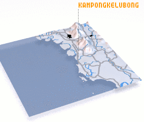 Places with similar names to Kampong Kelubong, Malaysia ::
// Kampong Kuala Abang (MY)
// Kampong Kuala Abang (BN)
// Kampong Kelibang (MY)
// Kampong Kolobuong (MY)
Disclaimer :: Information on this page comes without warranty of any kind |
||
|
Where is Kampong Kelubong? Elevation and coordinates ::
Latitude (lat): 4°34'0"N Longitude (lon): 100°41'0"E
Elevation (approx.): 8m (map arrows pan, magnifying glasses zoom) |
||
|
Visiting Kampong Kelubong? Hotel/Accommodation ::
Book a hotel in Kampong Kelubong Travel Guide ::
Buy a travel guide for Malaysia rental cars ::
car rental offers GPS waypoint ::
download a GPX waypoint (PoI) of Kampong Kelubong for your GPS receiver
|
||