|
search place name
|
||
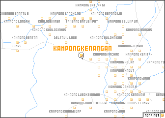
Kampong Kenangan (Johor, Malaysia)Kampong Kenangan is a town in the Johor region of Malaysia. An overview map of the region around Kampong Kenangan is displayed below.
regional and 3d topo map of Kampong Kenangan, Malaysia ::
Kampong Kenangan airports ::
The nearest airport is MKZ - Malacca, located 61.7 km south west of Kampong Kenangan.
Other airports nearby include KUL - Kuala Lumpur Intl (113.7 km west), KUA - Kuantan (144.4 km north), JHB - Johor Bahru Sultan Ismail (147.3 km south east), DUM - Dumai Pinang Kampai (177.7 km south west), Nearby towns ::
Kampong Paya Luas Batu Lapan (1.9km east) //
Batu Enam (1.9km north) //
Kampong Paya Lang (1.9km north) //
Kampong Batu Bakar (3.7km east) //
Kampong Gajah Mati (4.1km north east) //
Kampong Tanjong Batu (4.1km south east) //
Kampong Putat (5.2km south east) //
Delta Village (5.2km north west) //
Kampong Kuala Tandong (5.6km east) //
Kampong Machak (5.6km east) //
Kampong Kuala Paya (5.9km east) //
Buluh Kasap (5.9km east) //
Kampong Tandong (5.9km east) //
Kampong Buloh Akar (6.7km north east) //
Kampong Bachang (7.4km east) //
Tambang Batu Empat (7.4km north) //
Kampong Batu Lima (7.6km east) //
Kampong Tambang Batu Enam (7.6km north) //
Kampong Tambang Batu Tujoh (8.3km north east) //
Kampong Telok Kelubi (8.3km south east) //
Kampong Lubok Kasai (8.3km south east) //
Kampong Durian Daun (8.3km south east) //
Kampong Kuala Gemas (8.3km north west) //
Kampong Bukit Tangkong (9.3km south east) //
Kampong Serakek (9.3km north east) //
Kampong Bukit Mentaus (9.3km south east) //
Kampong Bukit Pupok (9.3km south east) //
Kampong Kuala Gemas (9.3km north west) //
Kampong Alai (10.5km south east) //
[all distances 'as the bird flies' and approximate]  Places with similar names to Kampong Kenangan, Malaysia ::
// Kampong Kenangan (MY)
Disclaimer :: Information on this page comes without warranty of any kind |
||
|
Where is Kampong Kenangan? Elevation and coordinates ::
Latitude (lat): 2°34'0"N Longitude (lon): 102°43'0"E
Elevation (approx.): 24m (map arrows pan, magnifying glasses zoom) |
||
|
Visiting Kampong Kenangan? Hotel/Accommodation ::
Book a hotel in Kampong Kenangan Travel Guide ::
Buy a travel guide for Malaysia rental cars ::
car rental offers GPS waypoint ::
download a GPX waypoint (PoI) of Kampong Kenangan for your GPS receiver
|
||