|
search place name
|
||
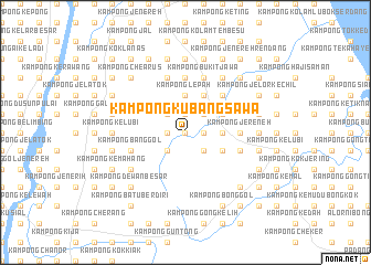
Kampong Kubang Sawa (Kelantan, Malaysia)Kampong Kubang Sawa is a town in the Kelantan region of Malaysia. An overview map of the region around Kampong Kubang Sawa is displayed below.
regional and 3d topo map of Kampong Kubang Sawa, Malaysia ::
Kampong Kubang Sawa airports ::
The nearest airport is KBR - Kota Bahru Sultan Ismail Petra, located 35.1 km north of Kampong Kubang Sawa.
Other airports nearby include NAW - Narathiwat (97.5 km north west), TGG - Kuala Terengganu Sultan Mahmud (101.3 km south east), PAN - Pattani (165.1 km north west), KTE - Kerteh (190.3 km south east), Nearby towns ::
Kampong Seligi (0.0km north) //
Kampong Permatang Rambai (1.8km east) //
Kampong Permatang Sungkai (1.8km east) //
Kampong Banggol Pak Esah (1.9km north) //
Kampong Alor Geliong (1.9km north) //
Kampong Berangan (1.9km north) //
Kampong Sungai Durian (1.8km west) //
Kampong Bendang (1.8km west) //
Kampong Tok Harun (1.8km west) //
Kampong Permatang Gading (2.6km north east) //
Kampong Gong Serai (2.6km south east) //
Kampong Alor Batu (2.6km north west) //
Kampong Banggol Setol (2.6km north west) //
Kampong Tok Derasat (2.6km north west) //
Kampong Siam (2.6km south west) //
Kampong Haji Su (3.7km east) //
Kampong Sungai Kelong (3.7km east) //
Kampong Tok Yakob (3.7km east) //
Kampong Wakaf (3.7km east) //
Kampong Bukit (3.7km east) //
Kampong Batu Sebutir (3.7km east) //
Kampong Lepah (3.7km north) //
Kampong Banggol Jenereh (3.7km north) //
Kampong Tubok Jakar (3.7km north) //
Kampong Chat (4.1km north east) //
Kampong Banggol Dollah (4.1km north east) //
Kampong Pak Omar (4.1km north east) //
Kampong Bukit Abal (4.1km north east) //
Kampong Panggong (4.1km south east) //
[all distances 'as the bird flies' and approximate]  Places with similar names to Kampong Kubang Sawa, Malaysia ::
// Kampong Kubang Sawa (MY)
Disclaimer :: Information on this page comes without warranty of any kind |
||
|
Where is Kampong Kubang Sawa? Elevation and coordinates ::
Latitude (lat): 5°51'0"N Longitude (lon): 102°19'0"E
Elevation (approx.): 23m (map arrows pan, magnifying glasses zoom) |
||
|
Visiting Kampong Kubang Sawa? Hotel/Accommodation ::
Book a hotel in Kampong Kubang Sawa Travel Guide ::
Buy a travel guide for Malaysia rental cars ::
car rental offers GPS waypoint ::
download a GPX waypoint (PoI) of Kampong Kubang Sawa for your GPS receiver
|
||