|
search place name
|
||
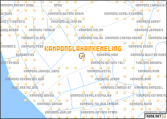
Kampong Lahar Kemeling (Kedah, Malaysia)Kampong Lahar Kemeling is a town in the Kedah region of Malaysia. An overview map of the region around Kampong Lahar Kemeling is displayed below.
regional and 3d topo map of Kampong Lahar Kemeling, Malaysia ::
Kampong Lahar Kemeling airports ::
The nearest airport is AOR - Alor Setar Sultan Abdul Halim, located 18.3 km south east of Kampong Lahar Kemeling.
Other airports nearby include LGK - Pulau Langkawi Intl (65.1 km west), HDY - Songkhla Hat Yai Intl (66.9 km north), PAN - Pattani (105.2 km north east), PEN - Penang Intl (114.7 km south), Nearby towns ::
Kampong Kereta Api (0.0km north) //
Kampung Asun (1.8km east) //
Tok Lu (1.9km north) //
Kampong Wang Perah (2.6km south east) //
Kampong Tok Thong (2.6km south east) //
Kampong Jambu Ayer (2.6km south east) //
Kampong Manggol Bongor (2.6km south west) //
Padang Sira (2.6km north east) //
Kampong Tanjong (2.6km north east) //
Kampong Pulau Kekabu (2.6km north east) //
Kampong Megat Dewa (3.7km east) //
Kampong Changkat Pak Ubin (4.1km south east) //
Padang Perahu (4.1km south east) //
Kampong Pulau Maharaja Atas (4.1km south east) //
Kampong Changkat Bacti (4.1km south east) //
Kampong Kereta Api (4.1km south east) //
Kampong Belukar (4.1km north east) //
Kampong Masjid (4.1km north east) //
Kampong Pulau Nibong (4.1km north east) //
Kampong Malele (4.1km north east) //
Kampong Telok (4.1km north east) //
Kampong Tok Kepak (4.1km south west) //
Kampong Pulau (4.1km north east) //
Kampong Perin (4.1km north east) //
Kampong Siputih (4.1km north east) //
Kampong Ketol (5.2km south east) //
Kampong Binjal (5.2km south east) //
Kampong Padang Nyior (5.2km south east) //
Kampong Kubang Chenok (5.2km north east) //
[all distances 'as the bird flies' and approximate]  Places with similar names to Kampong Lahar Kemeling, Malaysia :: Disclaimer :: Information on this page comes without warranty of any kind |
||
|
Where is Kampong Lahar Kemeling? Elevation and coordinates ::
Latitude (lat): 6°20'0"N Longitude (lon): 100°19'0"E
Elevation (approx.): 6m (map arrows pan, magnifying glasses zoom) |
||
|
Visiting Kampong Lahar Kemeling? Hotel/Accommodation ::
Book a hotel in Kampong Lahar Kemeling Travel Guide ::
Buy a travel guide for Malaysia rental cars ::
car rental offers GPS waypoint ::
download a GPX waypoint (PoI) of Kampong Lahar Kemeling for your GPS receiver
|
||